
We left Apalachicola under sunny skies. We had a very pleasant night on the hook in the Apalachicola River. It was tempting to stay another day, but a weather window was opening for us to do the Gulf Crossing, so we decided we should jump through it, less we be stuck in Apalachicola or Carrabelle for another couple weeks before the next window. Good Gulf crossing weather windows are few and far between this time of year. This one is going to last 3 days. So, we had to go.
Again, we had beautiful weather. Sunny skies and an east 10 knot easterly breeze. It was an easy trip towards Carrabelle. We thought of stopping there, but decided Shipping Cove looked too good. There is a whole lot of nothing here, but it is peaceful and beautiful and places us in a good position to jump off from.
On the way here, Brenda finally got her dolphin photo. She has been working at it for years. We've never had a really good SLR camera to work with so what you see here was taken with a cell phone - an Android, to be more precise.


She also got some decent shots of the Oystermen at work.


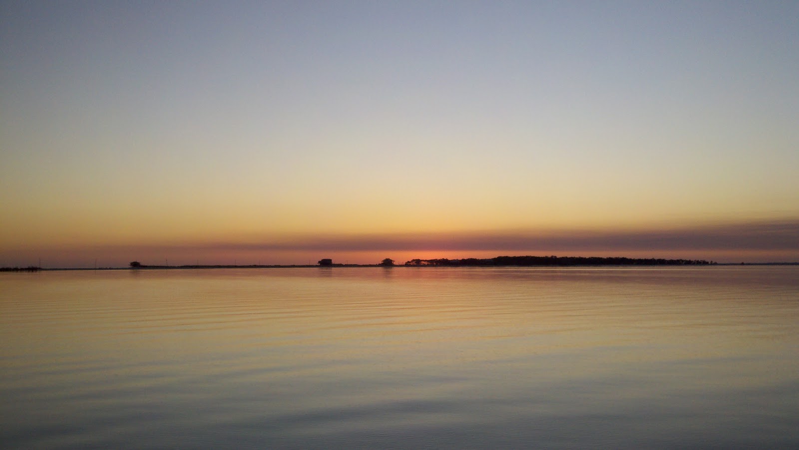
Well, we had yet another beautiful sunset, and another perfect sunrise.


Our journey will now take us 140 miles almost due south where we will anchor behind Ancelote Key. There, we will sleep for a day or so and then work our way up the Ancelote River to Tarpon Springs. We hope we will see manatee in the bayous up there. I've heard they are in there this time of year because the water just about everywhere else is just too cold. We had originally hoped to get into the Crystal Springs area, but there just isn't enough water for anything that draws more than 3 1/2 feet. So, maybe the next time around. This will be an overnight passage of just under 20 hours. Our float plan is filed and we are ready to go. Our plan is to hit East pass at just before 1600. At an average speed of 7.5 knots, we should be arriving in the Ancelote Key area around 10:30 or so; just in time for the high tide. I'll tell you more about it the next time. In the interim, we are looking at good weather and hoping for a completely boring trip.
Bye for now.
************
THE GULF CROSSING –
We spent the day preparing the boat for a 140 mile trip across the eastern part of the Gulf of Mexico, from our perch in Shipping Cove to Tarpon Springs on the west coast of Florida. As I said before, the GICWW ends in Carrabelle at MM 379 EHL. We have completed the GICWW. The ICW picks up again just outside Tarpon Springs at the mouth of the Ancelote River. At the moment, we are anchored in Ancelote Key, a state park, waiting for the rain storm to pass so we can go up the river approximately 6 miles and visit the town of Tarpon Springs. Rumor has it, a visit to Tarpon Springs is the next best thing to visiting a Greek island. I’ll write more about this later. In the mean time, let me tell you about the Gulf Crossing.

As some of you know, any lengthy open water passage requires quite a bit of planning. Moreover, if the lengthy open water passage is long enough that you have to run through the night, planning is critical. Accomplishing even the simplest tasks on a moving boat during the day is tough. Try it at night.

Everything had to be in order. We confirmed our fuel supply. We confirmed our water stores. We confirmed we had plenty to eat. We organized and pulled out the warm clothing we would need, including gloves, hats, and foul weather gear. We made lots of “hand food” in advance and stored it so we could access it easily. We checked to make sure flashlights had fresh batteries. We changed the Old Girl’s fuel filters and oil. We checked the bilge pump and made sure the hose and filter were clear. We made sure all records and record keeping was current and up to date. And, among other things, we made sure all electronic navigation equipment and the auto-pilot were in good working order.

Additionally, we downloaded and printed all the necessary charts we would need to get us out and in. We formulated our back up and bail out plans. We tidied up the boat and made sure that anything that could “fly” was well secured inside the cabin. The dinghy was hauled and the outboard motor secured. Windows were cleaned, and wiper blades checked and lubed. We just completed a Vessel Safety Inspection at Port St. Joe, so our safety equipment including, but not limited to flares, PFD’s, signaling devices, documentation, fire extinguishers, etc., were all up to date. Most importantly, we plotted our intended course and at least two other courses based on possible weather conditions. It’s always good to have more than one option. Basically, we did all those things prudent mariners do before a passage; all those cool things you learn in Power Squadron courses and though experience.

All day, we monitored the weather and looked for any variations in the forecast patterns. It looked pretty good for an open Gulf crossing. The wind was forecast to build a little during the night from the north and then swing to the north east in the late morning hours. Our navigation planning told us we could leave at around 4:00 in the afternoon and expect to arrive at our anchorage in Ancelote Keys at approximately 10:30 or 11:00. The National Weather Service, Sailflow, Weather Underground, and a host of other Gulf weather sites all agreed. That’s a good thing. If you go boating enough, you will find that bad things generally happen when all the best ocean meteorologists argue publically. In this case, however, there was harmony.

There are a bunch of unemployed captains that literally scour the docks in Carrabelle looking for a ride. This makes sense. There are many Loopers who are older and perhaps not as nimble as we are or they once were and this is a tough crossing even when the conditions are good. Taking on experienced crew or hiring a captain can save a marriage. We all know how many wonderfully equipped boats there are for sale at the end of the Baja Ha Ha, for example. I suspect there are others for sale at the conclusion of this crossing as well. Then again, many of the Loopers, especially the older crowd, are tough birds, and their wives are a lot tougher than they look. In any event, if everything goes perfect, it is a long and boring passage. The real difficulty lies in the fact that, it is long enough that you get real tired towards the end BECAUSE it is not long enough to develop any rhythm. It is simply crucial that you do not make any mistakes at the end when you are most tired and ready to be done. Passages of 3 days or more are generally a lot easier after the first couple days because your body and mind have time to adjust to the “motion of the ocean”, watch schedules, power consumption requirements, etc. Assuming all else is equal, of course.

We did see some folks take off in the morning in boats capable of 25-30 knots. Obviously, they make this 140-170 passage all during the daylight hours. There was simply no hope for us in that regard. There were several other boats that were gathered together at the Landings Marina in Carrabelle who would be running closely packed to Clear Water Pass. That was about 50 miles further south than Tarpon Springs. To our knowledge, nobody else was leaving for Tarpon Springs. We saw them all leaving together in a parade. We talked on the radio to our friends who were amongst them and wished them well.

We knew we would be travelling alone. We also knew we would not be taking on additional crew for this passage. Many folks did. We prepared and filed a float plan and sent it off to the parents. Even though this was only a 140 mile passage, almost the whole time, we would be 30-50 miles off shore; beyond the effective range of any cell phone or VHF radio. Help, if needed would be very far away, indeed. However, like most of the Gulf, and based on a review of the charts, we could anchor literally anywhere along our course line. The deepest water we would see was only 80 feet deep and we carry enough chain for a 4:1 scope in 80 feet. Certainly not ideal, but it would help in a pinch.

After completing our preparations, we tried to nap, but sleep was not forthcoming. I guess we were too excited to sleep. So we just relaxed, talked on the phone, played games on the IPAD, and otherwise enjoyed the spectacular weather in Shipping Cove.

At 3:35 in the afternoon, we whipped the old hamster (started the engine), gave her a few minutes to warm up and get loose, and then pulled the anchor. We headed west out of Shipping Cove to R6 and then passed it on the left as we headed out into the Gulf – R6, R4, R2 - Gone. The water was flat as could be; barely a ripple disturbed the surface. The sun was bright and there were only light clouds in the sky. So, we got comfortable, set the autopilot on course, and went down below to go to sleep – JUST KIDDING!!!! WE DID NOT!!!! That would be completely stupid. I hate to admit that I know folks who do this.

No, really. We kicked back in the wheelhouse and enjoyed the ride. We slid into our watch schedules at around 9:00 pm. I basically had the wheel since we left Shipping Cove, but Brenda took over for a while here and there between 4:00 and 9:00 p.m. I took the first “real” wheel watch at 9:00 pm. We planned to do 3 on and 3 off. While one ran the boat, the other slept (or at least tried to get some shut eye).

My first watch was uneventful. Between 9 and 12, basically nothing happened. However, because of an increase in the north wind that was coming in on our port quarter, the boat was “cork screwing” quite a bit. By this time, the North wind had plenty of fetch to kick up 3-5 foot, tightly packed wind waves, so the ride was becoming less comfortable than before. So, I made a slight course change by moving the waypoint mark from the North Ancelote Keys entrance buoy to the South Ancelote Keys buoy. This changed our course by several degrees further south, which effectively produced a much more comfortable ride, and only increased our distance to travel by 5 nautical miles.

When Brenda took her watch at midnight, I explained that our waypoint changed and ran over the drill with her. I then got to stretch out on the bench for a little while. I think I may have actually slept for a half an hour. The rest of the time, I curled up there under a blanket and closed my eyes. Runway the cat navigator curled up next to me. It was pretty cool.

At 0300, I took the watch again. During Brenda’s watch, the wind picked up even more and we were feeling a good solid 15 kn on the port quarter again. The wind was already starting to shift to the north east. This was a little earlier than predicted; it was 6-7 hours earlier than forecast. This time, I adjusted the response on the autopilot to soften the corkscrew effect of the wind on the port quarter and held the line. It was becoming uncomfortable, but was by no means dangerous. So, on we went.

Brenda took the wheel at 0600. I tried to sleep, but there was no way. Just as Brenda started her watch, there was a massive shift of the wind. Within literally minutes, the wind went from 010N to almost 075 NE, and started to blow around 20. Now things got very uncomfortable. Brenda was working on some adjustments when a beeper went off and loud noises were coming from the things below in cabinets shifting loudly. So, I got up, discovered the source of the beep, and with no argument from the second captain, I took the wheel again.

At this point, we were just under 50 miles from our destination; only 7 more hours to go, before we were anchored and settled. It was still dark, but we knew the sun would be coming up soon. The sky was definitely cloudy and we had no moon. It was very dark, but every now and then, the star, Archurus, popped out of the clouds and I could see her out in front of and above the port side of the bow. In a strange way, out there in the dark, it is comforting to see something – anything – that you can rely on. I knew, for example, that if I kept that star in the left front window, we were heading in the right direction. For several hours during the night, Archurus would pop in and pop out. I was happy to see her bright light, and sad when she would disappear.

Back to reality. Now, I had the wheel. This time, sensing the motion of the ocean, I decided that the better call would be to lessen the fetch. We could no longer comfortably hold our course. We had to shorten the distance over which this north east wind was blowing over the water. So, we made a 90+ degree turn, a perfect gibe, to put our nose slightly off the wind. Immediately, the motion went from being very uncomfortable to completely tolerable. Sometimes you have to do that for the safety of the vessel and the sanity of the crew. We had more than enough fuel even if we had to change course over 100 miles, so why not look for the most comfortable ride.
After about 2 hours and 15 miles of fetch shortening effort, the seas were laying down considerably, and we gibed again, this time, we headed due south towards our original waypoint. Now, the sun was up and we could definitely see. At this point, the effort changed, we no longer had to hang on to keep from sliding across the wheel house. Rather, we had to meticulously search the water for trap buoys. The crab and lobster fisherman have literally thousands of pots out here marked only by 6” diameter styrofoam balls, many of which are painted blue…..blue, I say. How stupid is that?! When I say thousands of them, I mean it. Every couple seconds, we spotted another, and every couple minutes, we would have to change course to avoid one. After a while, we began to see a pattern. They were all laying on or near a 5-6 fathom (30-36 feet for you land lubbers) curve, and wherever the bathymetric contour lines weaved in that depth range. So, we figured, we would head out into water deeper than 6 fathoms and have a clear passage. Well, it helped some, but did not rid us of the problem. Fishermen are like explorers. They will lay their traps where they THINK they will catch fish, not where they know the fish are, because fish generally don’t advertise their positions. (That’s why they call it “fishing” as opposed to “catching”. And if it were that easy, everyone would do it, right?)
So, for the next 4-5 hours, we continued heading towards our anchorage all the while dodging crab pots. Our deviation cost us about 2 hours when all was said and done. But, it was a great trip. It was challenging while, at the same time, it was nothing really worse than we have experienced in the past. We have had much rougher water coming home from Pelicans Harbor on Santa Cruz Island back in California. The only thing that was really different is that on that passage, the water tends to be nearly 2 miles deep, and we would generally be operating in day light. This was challenging because it was a night passage. During the night, and especially on a power boat, you are more of a passenger than an active participant. There are times when you have to control the boat, but given good conditions, you set the pilot and go along for the ride while monitoring systems and making sure the boat is doing what you want it to do. So, it can be boring, but it can also be challenging. I would have to say that this passage was somewhere in between. Well, now that this is done, what do we have to look forward to?
We anchored in Ancelote Keys in the area recommended by the cruising guides and went to sleep. Today, it is raining cats and dogs, so we’ll just stay put. Tomorrow, however, we intend to run up the Ancelote River to the town of Tarpon Springs and then head down the West Florida ICW, 150 miles to the mouth of the Okachobee Waterway. This will be fun. There are plenty of nice spots to anchor, and plenty of places to visit along the way.
Be well, Y’all.  |
| On this leg, we hit 1000 nm since we began back in Rockport, Texas. The ODO shows the total mileage since we bagan, and the Trip meter shows our mileage since we last got fuel. |
No comments:
Post a Comment