Tuesday, November 29, 2011

CLIFTON, TENNESSESE, A REAL SUPRISE

While we are sitting here in the boat yard enduring repairs to our transmission, I thought I should take some time to update the blog about some of the places we have visited prior to getting here.  The first place I want to describe is Clifton, Tennessee.

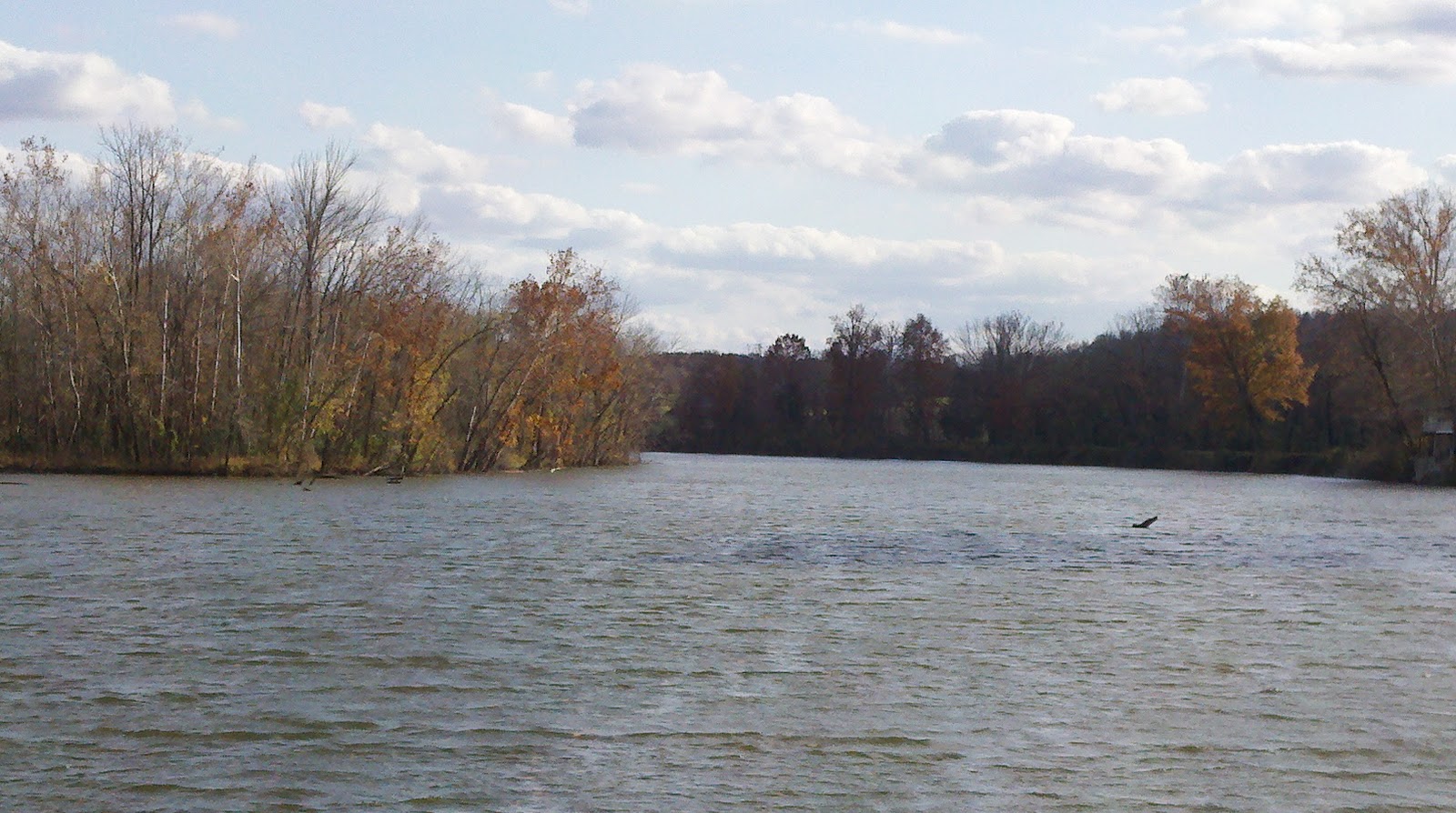
We stopped in Clifton because it seemed like a logical thing to do.  Clifton is sort of strategically located between Pebble Isle Marina and the Pickwick Lock and Dam complex.  A faster boat could make it all the way from one to the other and then on to the marinas and anchor grounds on the other side of the Pickwick Lock.  We, however, no longer have enough hours of daylight to make such a long run without running into darkness.  The previous night, we anchored behind Double Island as we weren’t even going to make it from Pebble Isle to Clifton.  So, it was either run close to 80 miles from Double Island to Pickwick Lock and then a couple more to a stopping place, or run another 10-15 miles to Clifton and stage for the lock from there.  We chose the latter.  We are very glad we did.


First off, we cannot thank the folks at the Clifton City Marina enough for their gracious hospitality.  We had some pretty rough weather for the couple days we were there and so we were basically stuck in heavy rain, fog, and very cold wind.  Nevertheless, we were made to feel welcome.  There is a restaurant/convenience store/cafĂ© on the premises.  We managed to get well acquainted with the owner of the facilities and ended up spending our evenings visiting with him and his friends who all seemed to gravitate to the facility for cocktails and fun each evening.  We had a great time partying with the local folks and as a result, learned a lot about life in this part of the world. 

We even had the pleasure to meet Glen, an old guy who recently retired after working as a Chief Engineer and River Pilot for several of the barge companies on the Western River System.  He spent more than 50 years running cargo on the rivers.  Today he is trying to retire.  Unfortunately, due to his inate ability to fix things, he is actually in greater demand now than he was before he retired. I enjoyed talking with him about life on a riverboat and what it was like shoving cargo loads of the rivers.  His son is now a river pilot on the lower section of the Mississippi.  He's one of those guys at the wheel of a towboat moving 42's up and down the river.

The owner of the facility is an old boy named Gene.  His family roots in Waynesboro County reach as deep as the early 1870’s.  His great Grandfather, his Grandfather, his Father, and then he were all farmers in the area raising various crops over the years including soybean, corn, and sod, not to mention a variety of livestock.  He left the farming business, however, and attended College at Ole Miss University where he earned a degree and a credential as a pharmacist.  He has owned a pharmacy for many years and even sat on the State Legislature for a couple terms.  His father was a county judge.  He and his family might be considered a “leading family” in the Clifton area.  It was great to sit and talk with him about the good old days.  It was even more interesting to see him walk in one afternoon carrying his rifle and appearing a bit disgusted with the fact that he missed the beaver that has been under A dock munching on the pontoons.  (Now that’s not something you see every day at a marina in Southern California).

The manager at Clifton City Marina is a woman named Sonya.  She is one of the sweetest people we have ever met.  She was all country.  She had a big smile and was very helpful and extremely knowledgeable about the area.  She is from a farming community in Missouri, but came to Clifton several years ago and married a man called “Coach” and they live on a houseboat in the Marina most of the year.  Sonya is one of those “take charge” kind of gals and, although she really had no intention of managing the marina, saw a need, felt a twinge of sympathy for old Gene at a time he was getting ripped off by the help, stepped up, told Gene she would manage the joint, fired all the help, and helped the marina start over.  It’s a good thing she did, too.  This marina is a small version of a truly 5 star marina that is immaculately clean and loaded to the teeth with facilities for cruising boats.  She and Gene spearheaded the effort to completely renovate the marina.  I would not pass through here again without stopping in to see Gene and Sonya.

So, Clifton City Marina had a courtesy car.  It’s nice showing up after every other downbound cruiser has already passed since there is simply nobody else around.  This status seems to afford us the best slips in the marina, not to mention virtually unlimited use of the courtesy cars.  So, once again, the keys were tossed our way and we were told to go have fun.  So we did.  As a result, we learned a lot about this little riverfront town in Waynesboro County, Tennessee.


It is said that, Clifton would not exist without the Tennessee River. In fact, the town got its name because it sits on a "cliff" high above this great River.  Historically, there has always been a special link between the river and the town. Clifton's Main Street ends where the town began- on the riverbank.  At the end of Main Street, is a very cool memorial/monument decorated with ornamental trees, flowers, and a splendid rock wall and iron gate.  To one side is a war/veterans memorial with a lighted American Flag high above. Most important, however, is the vista from this location. When you stand up here and overlook the river, you can begin to understand the historical importance of this town.  This is the place where several important river crossings took place during the Civil War took place.  The view up here is wonderful even in foul weather.  In addition, for generations, the old road stretching down the slope provided access to the historic ferry landing.


The ferry landing and the surrounding riverbank are now silent. The big boats once so essential to the commerce of Clifton stopped docking here decades ago. The gunboats and transports teeming with Yankee soldiers are long gone. The old mail boat is now a fading memory. Even the ferry service that had existed in or near Clifton since 1818 hasn’t run since 1998, shortly after a new bridge opened a few miles upstream.

Settlers first came to the Clifton area in the early 1800's. Clifton was originally called Ninevah, but the name was changed in 1840 when work began on the turnpike. Clifton wasn't really much of town before the turnpike, and the old timers traditionally regard 1840 as the date of Clifton’s founding. As a result of the construction of the turnpike, parts of Southern Middle Tennessee now had access to the river here. In the early days the turnpike was used to important in the transportation of crops from the local farms as well as pig iron from the foundries and furnaces that once prospered throughout the County.

The Civil War was a traumatic event in Clifton's history. While most surrounding communities were loyal to the Union, Cliftonians allied themselves with the Confederacy. In the second year of the war, the Tennessee River became a vital invasion route for Union forces. Clifton, to its great misfortune, was located in a strategic position on that river. Early in 1862 Union forces occupied Clifton, and they stayed here for most of the remainder of the war. The Union stronghold in Clifton was Stockade Hill, and the officers' headquarters were located in what is now the front yard of Frank Hughes School, right smack in the middle of Main Street. Several skirmishes were fought around Clifton, and Confederate General Nathan Bedford Forrest conducted an important raid here in December 1862. Most of Clifton was also burned to the ground by Union soldiers. Legend has it that only four homes in Clifton survived the Civil War. The Presbyterian Church is the only public building still standing from that era. At various times during the war it was used as a hospital and misused as a horse stable by the occupying Union forces. The front of the church still bears the scars of where Union soldiers pulled out part of the brick wall to make a wider opening. 

In the decades following the Civil War, during a time when Steamboats were king, Clifton entered its first golden age.  During the late 1800's and early 1900's, Clifton was an important river port. Moreover, countless crossties cut from the vast timber resources of this area were shipped from Clifton and used to build the nation’s growing railroads.

Money poured into Clifton like never before. Many of the old homes and buildings in town date from that prosperous era. During those years Clifton developed a reputation as a rowdy place.  In fact, it was said that Main Street was once lined with drinking establishments.  As such, fights were common and murder was not uncommon.  This is not the case today at all.  Cliftonians tend to be a peaceful group, and the crime rate is very low.


The "Roaring Twenties" were not good for Clifton. As a result of America’s growing reliance on cars and trucks, the river landing at Clifton lost most of its importance.  Major roads and highways were being constructed outside of Clifton.  As a result, Clifton entered a long period of gradual decline. In the 1930's Clifton, like the rest of the world, struggled to survive the Great Depression.

During these seemingly dark days, one of Clifton’s residents achieved something great.  In 1933 Clifton's own T.S. Stribling won the Pulitzer Prize for Literature with The Store. Today Mr. Stribling's home on Water Street serves as a library and museum.

It was also in the 1930's that another famous man reportedly came to Clifton. German General Erwin Rommel, Hitler's legendary "Desert Fox," supposedly spent a night in Clifton's Russ Hotel while studying the Civil War tactics of Nathan Bedford Forrest.
In this building is the Clifton Cafe where they served great catfish.

Unfortunately, the 50's, 60's, and 70's saw little improvement and actually, the town continued to decline. Most of the businesses on Main Street eventually closed and many of the old buildings remained empty for a long time. Young folks left for better opportunities elsewhere. Many of the greatest old homes and public buildings fell into such a state of disrepair that they had to be torn down.  Long time residents of the area like Gene and Sonya still describe the sense of loss experienced when Clifton lost the old Russ Hotel and the original Frank Hughes School building.
This used to be a flat brick building until a local contractor bought the building and refurbished the entire building including the installation of the balconies with the very ornate New Orleans style metal work.

During the 1980’s however, things started looking up.  The State of Tennessee built a new prison facility at the edge of town providing much needed jobs. Then, in the early 1990’s, the state built a second and much larger prison facility providing even more jobs. During the next several years, new highways running in several directions through Clifton, as well as a bridge crossing the river a few miles above the town provided the outside world with good access to Clifton.

As a direct result of the prisons and the roads, Clifton transformed again.  Its citizens have developed a renewed appreciation for their hometown and took steps to develop new businesses and industries that benefit the locals and visitors. Nobody can argue that the natural beauty of this town provides a draw for visitors.  It’s just that nobody marketed this.  The new businesses that have developed in the area have provided fresh job opportunities.  As a result, folks have moved back to the central part of town.  This has led to a movement to restore many of the existing structures and to build new ones. The downtown Main Street looks really cool and most of the town is attractive and well maintained. Frank Hughes School has been enlarged with new classrooms and a spacious new gym. The city has developed new ball fields. Columbia State Community College now has a nice campus in Clifton, and the widely praised new Ross Creek Landing Golf Course (A Jack Nicholas designed course) is located just outside of town. Plans are already in the works to improve recreational facilities along the river. With the dawn of the new millennium, Clifton has apparently entered a new "golden age."  Clifton has become a great little town, certainly one we are glad we bothered to visit and explore. 

From here, we would conclude our voyage on the Tennessee River’s Kentucky Lake and then pass through the Pickwick Lock and onto Pickwick Lake.  Recall how I previously described how rivers with  navigation dams are really a series of linked lakes.  This is true of the Tennessee River. 

Saturday, November 26, 2011

A BRIEF POSITION UPDATE

Happy Thanksgiving to you all.  Sometimes it is hard to recognize all the things we are or should be grateful for each year, especially when your boat is broken down in Grand Harbor (Counce), Tennessee and you have no idea how long you will be stuck and how much it will cost to get the hell out of here. 

We were in the Pickwick Lock on Wednesday afternoon.  We motored for around 8 hours that day and got into the lock and tied up just fine.  We were lifted some 40 feet and all was well.  Unfortunately, when the gate opened and it was time to move on out of the lock, nothing happened.  I thought at first that we had somehow managed to snap a linkage cable.  hard to believe, it is true, but it is the only part of the transmission that you can see outside the bell housing.  Well, that wasn't it.  So, we notified the lockmaster that we weren't going anywhere, and then called Boat US for assistance. 

The symtoms were similar to that which we experienced arounr 6 years ago on our way home from Moro Bay, California.  That time, we were 15 miles off shore when we lost all propulsion.  Similarly, the engine contiued to purr like a kitten, but the shaft would not turn.  That time, it turned out to be a fractured dampener plate.  We waited for two hours for a tow while being constantly entertained by a circling blue whale.  This time was not nearly as interesting.

So, within an hour, Towboat US showed up and a fine captain named Davis took us in tow and pulled us out of the lock and up the Tennessee River for another 8 miles and delivered us to the dock at Grand Harbor Marina which was our ultimate destination for the day in any event.  It was there that we planned to enjoy Tanksgiving.  Ultimately, now, for the second year in a row, we had thanksgiving in or near a boatyard on a sick vessel.  I think from now on, I am leaving the boat in November and taking a vacation from cruising.  Abreojos seems to hate November.

We had a mechanic down yesterday (Friday) and in relatively short order, he diagnosed the problem the same as I already had:  the dampener plate.  So, this plate is similar to a clutch and it  lives inside the transmission.  It's a pain in the ass to get to and requires the engine to be suspended so the transmission can be separated from the main engine.  Our mechanic believes it can be done while the boat is in the water.  I'm not too sure about that but we'll see. 

So for now, we are at Grand Harbor Marina where TowboatUS brought us on Wednesday evening.  On Monday morning we will get towed again; only this time to the mechanic's yard which is about 2 miles from here.  Fortunately, he says we can stay on the boat during the repair process although it will be kind of like staying in your house with the roof off.  Again, we'll see how that goes.  For now, we have not too many other choices, especially since we have the two cats on board.

In the interim, however, I will be writing more about our stay in Clifton.  I will also write about our visit to Pickwick, TN which is where Grand Harbor Marina is located.  There sure are some wonderful folks here, and with the courtesy car, we have visited some interesting places. 

With the exception of a couple side trips here and there on the Tennessee River, this shit happens when we are less than 500 miles from closing the Loop we started just over a year ago.  Well, you just have to have faith that some things just happen for a reason. 

I'm waiting.

That's it for now. 

Monday, November 21, 2011

TENNESSEE RIVER....THE ADVENTURE CONTINUES

I think a glue should be named after Green Turtle Bay.  The place seems to have this effect on cruisers.  It's just so hard to leave.  GTB is simply comfortable.  It is a great place to stop if you need to get things done.  There is a full service boat yard.  Shopping is all nearby.  The courtesy cars are readily available.  The staff is more than friendly.  There is every thing you need right there.  And, it's really pretty there.  Of course we stopped there twice; once on the way to Nashville and once on the way back. 


 It wasn't easy, but we had to go. It seemed like if we didn't, we never would.  We'd have been stuck there like glue. We waited out a couple days of rotten weather before pulling the plug.  It seems as if we are in this all too common fall/winter weather pattern in which you get three days of rain followed by three days of sunshine, then another three days of rain.  Running in the rain is not a problem as we are nice and warm and dry in the pilothouse.  Running in the wind that foreshadows the rain is no problem either for the same reasons.  However, when the wind reaches 25+ knots, driving requires full concentration.  So, it's not as much fun.


Anyways, we left GTB in the rain.  It was certainly the tail end of the storm, so we had clear skies to look forward to.  Nevertheless, we had the wipers going.  When you leave GTB, you are on Barkley Lake on the Cumberland River.  You turn right, go down (up) for about a mile, and then turn right into the Barkley Canal.  This is a canal that takes you onto the Tennessee River where you then turn south and head up river.  Some of this up down, north south stuff might seem a little disjointed.  So, for the uninitiated river travelers, allow me to explain.


When you are on the US Western River System, there are a few things to keep in mind, each of which is an essential part of safe navigation.  The terminology is important because, when communicating with other vessels, we all need to be speaking the same language.  It's all a part of the Rules of the Road that all captains must master. 

Rule Number 1 - when you are traveling up stream, the reds are on the right.  Even if traveling up stream on a river taking you to the open ocean, when you are traveling up the river, or against the river current, the reds are on the right.  If you screw this up, there is a good chance you will end up aground.  This would not be good in the river because once you hit, you could find yourself pinned by the river current and getting off the grounding by yourself will become impossible.  Tipping over, rolling over, all sorts of ugliness become a distinct possibility.  So, keep the reds to the right when going up stream and you should be ok.

This is particularly important when you come to a place where two rivers merge and there is one of those aids to navigation which has a red or green on top of a red or green; the kind of mark that tells you where the main channel or preferred channel is. 
3.gif (6167 bytes)


This is a preferred channel or junction marker and indicates a bi-furcation in the channel. To navigate the preferred or primary channel, you should treat the marker as if it had all the characteristics of the color of the top band.  If you are headed up river, and if the top band is red, such as the one shown above, you would treat it as a red, starboard side marker (leave it on your right) to access the primary channel. If the top band is green, you would treat it as a port side marker to access the primary channel. If lighted, the marker would have a light the same color as the top band.

Rule Number 2 - when you are traveling up stream, you are "northbound" or "upbound" EVEN IF YOU ARE HEADING IN A SOUTHERLY DIRECTION.  This is a very strange thing to get used to.  For example, for over 100 miles on the Tennessee River, we have been travelling essentially south;  our headings have generally been between 120 and 220 depending on where we are.  Yet, we are a northbound boat.  We have to remember this when talking to commercial traffic.  You don't want to identify yourself as a southbound pleasure craft at a particular location when you are really northbound.  It would create confusion.  Recall I said it is important that we all speak the same language out there.  It is an essential part of the rules of navigation.


Rule Number 3 - you have to get used to the terms right descending bank (RDB) and left descending bank (LDB).  This can get confusing.  So, when you are traveling south up the river, you are traveling northbound and the right descending bank will be on your left.  Got it?  I didn't think so.  Here's the rub.  The sides of the river are described based on a downstream perspective.  Everything is right or left DESCENDING.  So, if you are going down stream or southbound (regardless of your actual compass bearing), the RDB will be on the right and the LDB will be on your left.  If you are northbound on the Tennessee heading towards the Gulf of Mexico, and the marina you want to stop at is on the RDB, you will be looking for it out the left side of the boat. 

Another thing that takes some real getting used to is understanding the water depth as it relates to the rivers.  You see, it is simply not enough to stay on the line where the barges go, if you have any hope of stopping for the night in an anchorage, or if you want to determine whether or not you can even get in.  Fortunately, there is a solution.  The river folks and the US Army Corps of Engineers refer to water depth on the rivers as the "Pool levels".


Under normal conditions, the locks on the rivers create lakes or pools.  For example, there are numerous locks on the Tennessee River between its origin quite a few miles past Knoxville and where it pours into the Ohio River.  For several days, after leaving GTB, we were on what is called Kentucky Lake.  It's the Tennessee River, but we were on the lake created by the Kentucky Lock and Dam.  The next lock we encounter will be the Pickwick Lock and Dam and then we will be on Pickwick Lake (still the Tennessee River). 

Anyways, the pool level is the height above sea level of the surface of the water in the pool.  You heard me correctly.  The pool level, the thingy we consider to determine whether or not there should be enough water under the boat to go in there, is a measure of the height of the surface of the water above sea level.

illustration of dams
This diagram from the TVA demonstrates the various pools created by the various
dams. Nine main-river dams form a “staircase” of quiet, pooled water and
controlled current — a continuous series of reservoirs that stretches along the entire
length of the Tennessee River. From its beginning just above Knoxville, the
Tennessee drops a total of 513 feet in elevation before it joins the Ohio River.

Now, it could be said that the primary purpose of the locks and dams is to maintain the navigability of the Western River System.  Afterall, probably more than a billion dollars of commerce takes place on these rivers each year.  So, entities such as the Army Corps of Engineers (ACOE) and the Tennessee Valley Authority (TVA) use the system of dams to control the water depth to ensure there is at least 9 feet of water in the main channels to guaranty barge traffic can move.  This all happened between 1930 and 1958 when the federal government exercised its jurisdiction over the Western River System and established certain depth authorizations.  So, it's really all about what to do with the river to make sure you can move a barge on it.

pie chart: coal and coke 40%; grains 10%; petroleum products 7%; iron and steel products 6% chemicals 5% stone, sand, and gravel 24%; all others 8%
According to the TVA, over 50 million tons of goods move up and down
the Tennessee River every year. Anything that’s transported in bulk quantities
makes a good candidate for shipping by barge.

The average person may think of a dam as a huge solid structure used to block the flow in a river and form a lake. This is not true of navigation dams, like those on the upper Mississippi or on the Tennessee. These dams are not solid but are a series of concrete piers across the river with movable gates between the piers. A dam is formed when the gates are lowered, causing the water level upstream of the dam to rise and form a slack-water pool deep enough for navigation. Each dam is operated to accommodate river flow conditions. In normal operation, all gates are partially open, to allow water to flow through. As the river flow increases or decreases, the gate openings are increased or decreased accordingly.  These increases or decreases affect the depth of the pool as well as changes in water flow caused by precipitation or draught.


In each pool, field surveys have established the ordinary high water profile, and the location of the primary control point. Project pool elevation is maintained at the primary control point.  So, the depth of a pool is related to this.  Again, the pool level is a factor of height of the surface of the water above sea level.  The bottom of the river is also measured in terms of height above sea level.

Here is an example to make this perhaps a little less confusing:

Suppose you are cruising upstream on Wheeler Lake and are nearing Decatur, Alabama (which we will be soon enough).  You decide to leave the main channel to enter an anchorage near Mile Marker 301 on the LDB.  The official Tennessee River Chart shows the river bottom where you wish to leave the channel has an elevation of 538 feet above sea level.  It also shows a contour.  This contour represents a change in the river bottom.  In this example, the contour shows an increase in elevation to 550 feet.  As you have probably guessed, if the bottom of the river comes up, it is getting shallower.

Now, assume that the charts show that the elevation of Wheeler Lake at normal pool is 556 feet.  This means that as you leave the navigation channel, you can espect the water to be 556 minus 538 or 18 feet deep.  It also means you will encounter water only six feet deep or 556 minus 550. 

But, as you can certainly imagine, the pool levels change depending on the season. So, you will have winter pool, summer pool, fall pool, etc.  These seasonal levels may be different from "normal" pool.

Using the same circumstance above, imagine if there is a draught and the elevation of Wheeler Lake is only 551 instead of  the normal pool height of 556.  This means you have five feet less water under the boat at all times in Wheeler Lake.  Thus, using the same example above, you would have a water depth of 13 feet as you leave the navigation channel that would quickly decrease to one foot (551 minus 538 equals 13 and then 556 minus 551 equals 1).

So, now you are wondering how you determine the pool level.  First, normal pool is printed on the navigational charts published by the ACOE.  Next, you go to the TVA website and get the latest guage information for the lake you are navigating in.  Here is a link to the TVA for information on Kentucky Lake.   http://www.tva.gov/lakes/kyh_r.htm   Also, at a number of points along the river in each pool, there are guages you can read off to get this information.  These guage locations are published and often correspond with fixed mile markers.    It really takes some getting used to.  All of a sudden, your depth guage just became secondary.  What you really need is an altimeter.


What's more? When the government authorized the construction of the dams to make the rivers navigable, you can imagine what happened to the areas surrounding the river.  Yes, they were flooded and the government had to acquire all those lands.  Yes, in order to operate the slack-water pool system, it was necessary for the federal government to acquire interest in all real estate that would be subject to flooding caused by the use of the dams. Much of this land is now serving the public for recreational purposes and as wildlife refuges. Some land is owned outright and some is covered by "flowage easements" allowing artificial flooding of privately-owned land, if necessary.

What does this mean to us?  Well, it could mean a lot of things, but of primary concern is dropping an anchor.  Can you imagine dropping your hook and having it get tangled in what was once a barbed wire fence enclosure?  There are also what are called stump fields out there looming just under the surface, not to mention old roads and even, in some cases, structures.  So, we use a trip line at all times when anchoring on the rivers.  Thus far, we have managed to avoid hooking an old chimney.

So, in review, up might be down, right may be left, southbound might really be northbound, red could be green, and water depth in Tennessee is measured against its relation to the level of a distant ocean.  Got that?

In spite of all the aforementioned nonsense, we did manage to stop for a night after leaving GTB in a lovely spot called Cypress Creek.  It was beautiful.  We slid into this little round area almost completely surrounded by trees except for the south entrance which gave us a wonderful view down Kentucky Lake towards a bridge.  It was so quiet, you could hear those falling leaves echoing as they touched down on the surface of the water.  It was a very pleasant night.


In the morning, however, we upped anchor and headed on up the river to a place called New Johnsonville, Tennessee where we got a slip at the Pebble Isle Marina.  We selected this place because it has a courtesy car and was only a short distance from the town of Waverly where there was a movie theatre.


Brenda really wanted to go to the first showing of the film, "Breaking Dawn", the fourth film in the seemingly endless Twilight saga.  So, we made the run and the effort.  Unfortunately, the film was sold out for opening night.  We were not to be discouraged, however, and stayed another night.  This was really no problem since the marina was very cool, the people were ridiculously friendly, and we had a chance to cruise around in the courtesy van and see some sights.  Really there is not a lot to see other than some very beautiful countryside.  The town itself was small but spread out.  Cool stores, and a genuine small town feel.  The local highschool cheerleaders were all dressed and taking photographs in front of the county courthouse and the statute of some local civil war hero.  Ultimately, we did go to see the movie.  We had a nice time. We had dinner at the Waverly Cafe and then got in line.  I guess I thought that, since it was sold out the night before, there would probably not be much of a line for night number 2.  I'm thinking to myself, this is a small town.  You would think that everyone who wanted to see it would have already seen it.  Well, I was wrong.  Brenda ended up leaving me at the table and ran across the street to get in the steadily growing line.  By the time the ticket booth opened, the line was up the street and around the corner.  The crowd was great; everything from grandma and grandpa, to outback hillbillies, homegirls to highschoolers in big trucks.  It was great.  Dinner was good. The movie was more like "Breaking Wind", but we laughed a lot nevertheless.


After a stupendous breakfast called a "Shipwreck", we left this beautiful marina and continued heading south.  We ran all day and finally settled for the night in an anchorage called Double Island.  Now, there is no rule which says you must travel X number of miles per day.  However, sometimes there are logical breaks.  For instance, sometimes it makes sense if you have a considered destination 110 miles away, to travel that distance in 3 days, 33 miles per day (if possible depending on where the anchorages are).  You could do it in 2 days, but that's 55 miles per day and at 6.5 knots, that takes a long time and makes for a long day behind the wheel.  So, we like to break it up a little more.  However, sometimes, the distance between anchorages or marinas makes this kind of planning difficult.  So, from Double Island, we had basically a couple choices.  Note, however, these choices also consider the pending storm (the one which is right now as I am writing this dribble, pelting us with rain, thunder and lightning).

We could have chose to run 48 miles to an anchorage about 7 miles short of the Pickwick Lock and Dam and then go the couple miles through.  We could have chose a short 10 mile run to Clifton, Tennessee where there is a little city marina with a courtesy car and a nearby supermarket.  Well, we chose Clifton.  Not only does it have all that I just mentioned, it is a perfect day away from the other side of the Pickwick Dam.  As we are getting closer to Thanksgiving, we wanted to make sure we could have the things we need to make a perfect dinner......again.  We did the TG dinner in Nashville for my mother who is not hosting her own this year.  We thought it would be a nice thing to do.  Nevertheless, we will do it again for the two of us and we needed green beans and sweet potatoes.  I know this seems like a rather mundane reason to stop, but it is what it is.

Clifton is a very cool little town.  The marina is small, but it works and is very nice and new.  The folks here are really nice.  After we completed our shopping, we spent the rest of the day on Sunday  just hanging around in the cafe watching football.  I cannot remember the last time I did that.  It sure felt good to spend a day doing just about nothing. 


Given the intensity of this rain storm, I sure am glad we're tied up snug as a bug in a rug here in Clifton.  Between the wind and the rain, and the lightning and the thunder, we might be just fine out on a hook somewhere, but it's better to be inside, so to speak.  If this lets up soon, we may head out.  If not, we will stay in one more day and see what happens.  Like I said above, three days of crap and three days of nice, three of crap, three of nice.  It's just the cycle mother nature is in right now and we have learned to cope.  So, I'm making chili in the little crock pot Barry and Jodie gratiously bestowed upon us.  Never done that before.  We'll see how it comes out.

That's all for now.

Bye y'all

Monday, November 14, 2011

ON DOWN/UP THE TENNESSEE RIVER

The Cumberland River is now behind us, save and except for a small piece we shall take to the Barkley Canal which will then take us to the Tennessee River.  Some may say we arrived in the Ohio River Valley a little late in the year.  We, on the other hand, believe our timing was just right.  We were able to witness the change in colors of the trees from summer to fall.

We have no seasons in southern California so it is quite special to be a part of the changing of the seasons here.  Actually, it seems like we travelled south with the fall "blanket" all the way from Mackinac, MI where we first really started noticing the trees changing from green to reds and golds.  It has literally been like witnessing a wave moving from north to south, and with that wave, fall unfolded before our eyes.  Now, that wave has washed over us and the banks of the river have changed yet again.  The trees have on their winter clothes now and their golden leaves have all but fallen, leaving bare branches.  The banks are taking on several of the millions of shades of grey. 

Moreover, the water levels are changing from summer to winter.  The ACOE lets water out in anticipation of winter rains and storms.  So, where you might have had 25 feet in the river, you now have 15.  However, they have to keep enough water for the barges to keep running, so it's not a problem for us.  However, every now and then, we come across an anchorage where the cruising guide says we would be able to get in, only to find it high and dry.  We are not having any problems with water depth.  I'm just noting it as a change in the season.

Yes, it has become a lot more cold, save and except for those balmy days in the mid 60's, and the weather is certainly less stable than it is in the summer time.  Yet, I really like fall, and I really like the winter.  When it's cold out at night, it seems so much more fresh and clean.  You get this crazy fog on the water in the mornings that is loaded with ice crystals, and so it "hisses" as it skims over the surface of the water.

Certainly, there are fewer boats on the water.  Most of the locals have "hung it up" for the season and have moved on to other endeavors.  So, the waterways are pretty quiet.  Others doing the Loop and many of the "snowbirds" are pretty much long gone by now.  So, we have marinas to ourselves.  We have local restaurants and bars to ourselves.  We don't have to wait in line for the courtesy cars.  And the locals who depend on cruisers for their economy are sure glad to see that there is one more boat.  We are often asked if there is anyone behind us and our response is generally, "we don't think so."  So, here we are, behind the curve, behind the crowd, and loving it.  It means we get to pull out the winter sweaters, the Ugg boots, extra socks, and wool hats.  We may take an extra day getting somewhere because the time change means it gets dark sooner, or because the weather suggests we should hole up for one more day. 

We had a splendid trip back from Nashville, TN to Grand Rivers, KY.  We spent a couple nights anchored up the Harpeth River, a place we wanted to visit since we passed it on the way to Nashville.  The entrance is easy, and then you simply wind your way in.  You have to watch for logs sticking out above the surface.  I saw one chunk of wood protruding from the surface that looked from a distance like a green can buoy.  Upon closer inspection, however, aided by a pair of binoculars, it was definitely the top end of a tree.  The fact is simply that logs, dead heads, and tree knees are a part of life when travelling on rivers.  You just have to pay attention to what you can see.  You simply cannot worry about what you cannot see, although it is very important to have a working depth sounder and to pay attention to it.

We've seen some crazy things on the depth sounder travelling on the Cumberland.  Sometimes the water is 80 feet deep 10 yards from the RDB, and sometimes it is 10 feet, 100 yards from the LDB.  There is definitely a deep channel and it seems to almost always correspond with the sailing line.  So, stay on the sailing line.  I think I can sum it us as follows:  I don't mind running in 60 feet of water, and I don't mind running in 10 feet of water.  What I really mind is when it goes from 60 feet to 10 feet very quickly.  This really gets your heart beating and is what happened on several occasions when you get into river bends.  There is supposed to be this rule/assumption concerning deeper water inside the bend vs. slower moving water on the outside of the bend, or vice versa.  However, it does not always work, and you should just stay on the sailing line.  But, when you stay on the sailing line, you have to be prepared for some radical depth changes from time to time.  It just happens.

Anyways, the Harpeth River is a very well used river among the local fishermen and reacreationalists.  It is about as scenic as any river I have ever seen, if not more so.  We anchored about a mile and a half up the river right under these very tall limestone sedimentary bluffsHarpeth River day or night.    We could have stayed there longer, but we thought it best to move on as some more interesting weather was on its way.

The following morning, we pulled the anchor and moved on to Clarksville.  We had been there before, so there is nothing exciting to report.  We were, however, treated to a free night on the dock with electricity.  Seems there was some confusion back in the Parks and Rec Office where there are folks who manage the city dock that resulted in the folks there simply saying, "sorry for all the confusion, we aren't charging you anything for the dock, so have a nice time, and call if you need anything."  We certainly appreciated the hospitality and, for the record, the confusion I am referring to caused us no inconvenience or problem whatsoever.  So, it was just a friendly thing to do.

The next day, we ran all the way from Clarksville to Hopson Creek and anchored for the night.  With an hour less daylight available now that the clocks have been turned back for the fall, we have to be extra careful in terms of how far we run so as not to get caught out in the dark.  There are no lighted aids to navigation out here and it seems that only every so often is there a nav aid that reflects radar.  So, it is best for those who do not regularly run these rivers, to be off the water before sundown.  We had a nice night, but, again, because of the weather that we saw coming, we thought it best to leave really early and make it all the way back to Grand Rivers (Green Turtle Bay Resort) before the weather.

So what about this weather?  It was forecast as a steep pressure front that was anticipated to have been carrying lots of rain and thunderstorms.  The steep pressure gradient promised a lot of wind.  This storm had that for sure.  It blew hard enough the last couple days to inspire a NWS Wind Advisory for the areas we were to cover before getting tied up at GTB.  We got in a half a day before it arrived.  Brenda and I were in agreement yesterday that getting here (GTB) a day earlier than originally planned was a good idea.  Even on the rivers, as much wind as we have seen can push up a nice, closely packed 3-4 foot wind chop which, for us on this boat, is really more of an inconvenience than dangerous, but which would make things very dangerous if there were other problems.   We like to anticipate and factor in "potentials" as an important part of daily micro-cruise planning.  We may not know where we are going to be next week, or even tomorrow.  But we sure as hell are prepared for what we will encounter today. 

This reminds me of a discussion I saw recently on one of the cruiser forums I follow.  The discussion had to do with cruising guides and the various avenues available to cruisers, from books to the most interactive resources such as Active Captain.com.  It seems that there are those cruisers who rely on none of the above, but simply look to nautical charts for everything they need.  Then there are others who maintain libraries of information on everything from restaurants in town, to what sort of dock they will be tying to.  There are some who rarely if ever consult a guide, and others who spend all their time when they are not moving, in front of a computer screen tied to the Internet gathering information.  I have even heard of some cruisers who rent a car and drive to the next marina they plan to stop at to check it out before they go there. 

Suffice it to say that there are different kinds of cruisers who operate at different comfort levels, and for whom cruising means something completely different.  For some, cruising is the science of discovering; for whom information is everything.  For others, cruising is the art of discovering; for whom information is less important than discovering it along the way.   I think we are somewhat in the middle.  Any responsible cruiser should be fully cognizant of the weather conditions, the route for the day (including all the particulars), and where they plan to spend the dark hours.  Then, a responsible cruiser will have at least one back up plan.  Having a reasonable cruise plan requires the responsible cruiser to consult certain information before leaving, having considered the variety of resources available. 

There is one thing I think would be very helpful that I have not seen on any cruising guide resource before.  It would be very helpful if there were photographs of the dock, the river mouth, the marina entrance, the bulkhead, the whatever.  Generally the reference to the anchorage is a mile marker.  But, when the cruising guide references "mile marker 45.6" that is not always very clear.  So, in my opinion, a photograph would be helpful.   Again, there are those who might feel that even a photograph is too much like driving ahead to the next stopping point to check it out and stretches the limits of cruise planning reasonableness, but I think it would be just another resource to consider. 

Realistically speaking, there are many cruisers doing the Great Loop who are experiencing their first boating experiences on the Loop; they bought their boat to do this and have never really gone boating before.  They might have taken a few classes, and hired a captain for an afternoon to teach them how to dock the boat.  Brenda and I, on the other hand, have been very active cruisers together for more than 20 years.  On this boat, we have travelled more than 30,000 sea miles before this cruise.  We know what she will do and what she will not, and we have the advantage and the benefit of total familiarity with the vessel.  That takes a huge bite out of the cruising equation.  All we have to do is figure out how to get it from point A to point B without damaging the boat or her crew.  Easy, right?  Sure.  That's seamanship.

Well, we are awaiting the delivery of a new bilge pump.  Ours is one of those very expensive diaphragm pumps and it seems to have developed a hole in the diaphragm.  As the pump itself still works a little, but is more than 20 years old, I have decided to replace it as opposed to repair it.  It's pretty tired.  A bilge pump is an essential piece of equipment and it has to work.  So, we have dropped a dime (actually several) and it will be installed before we leave the dock.

Speaking of leaving the dock, we will soon be heading south again only this time, it will be on the Tennessee River.  We are still considering our options, but you can consider them all you want.  You have to start moving.  So, assuming we get that pump and get it installed, and get a break in the weather, we should be on our way tomorrow.  Don't ask me where we will be going, because I have not figured that out yet.  However, we will generally be heading south and will likely stop somewhere between 30-50 miles up the river as this is about the length of the stretch we are comfortable with in a day, and for which we will have daylight if we do not want to leave too early.  Sure we could go further, but what's the hurry?  It's already cold.  Will it get colder?  From what we hear it will.  We both kind of hope to be part of a snowy day on the water.  That would definitely be something we don't get to see in Southern California.

Bye Y'all.

Tuesday, November 8, 2011

NASHVILLE, TENNESSEE


We have visited many cities on this voyage of discovery, but few have had as much to offer as Nashville.  Having never been here before, we had no idea what to expect.  What we discovered, however, is a vibrant, bright, friendly, accommodating, easy to get around, interesting, clean and beautiful city.  There is a wonderful mix of old and new here.  This is a small city that has everything a big city has. From sky scrapers to professional sports teams, Nashville truly has it all.  The best thing about Nashville, however, is the music.


Nashville is known as "Music City USA".  You might be thinking that Nashville is all about country music.  Certainly, Nashville is the home of country music, and the birthplace of many of its varieties.  Nashville is the home of the Country Music Awards.  It is the home of the Country Music Hall of Fame and the Country Music Walk of Fame.  Certainly, when you think of country music, you think of Nashville.  However, the city's moniker is Music City, and as such, the name incorporates all genre of music from country, to blue grass, to gospel, to the earliest forms of rock 'n' roll.  It's all here, folks, and the music literally oozes out of the walls.


There are a couple streets where there is music all day and all night.  Broadway is where you will find all the Honky Tonks.  Second Street is where you will find more theatres for music.  There are also musicians performing in virtually every restaurant and bar throughout the city and on street corners as well.  You cannot avoid music in Nashville.  It's everywhere.


We stayed on the city docks.  There are A docks and T docks.  The A docks are on the city side.  There is power and water, and you are literally spittin' distance from Broadway and all of the wonders of downtown Nashville.  We shared the dock with a bunch of other boats that showed up for the weekend festivals, including the Titans-Bengals game that took place across the Cumberland River at LP Field.  We had to move to the other side of the river for most of the weekend, however, because the A docks were otherwise reserved in advance.  So we moved over to the T docks.  While there is no power or water over there, it was still conveniently located to the foot bridge that takes you right back into downtown Nashville.  In fact, this bridge takes you directly to the plaza between the Omni Hotel, the Symphony House, The Country Music Hall of Fame, and the Arena where the Predators play and where the CMA awards will be held this week.


As you know, my mom came from LA to visit us for a few days.  We had a great time.  She is a real sport to come out here and spend several days on this old boat.  We managed to have perfect weather and a great time.  We went out to a number of cool places including the Grand Ole Opry at the Rhyman Auditorium. 


Most folks have heard of the Grand Ole Opry.  It's an institution in the world of country music and every legend that has ever strapped on a guitar has probably played there in the 80 plus years of its existence.  The Rhyman Theatre is the home of the original Grand Ole Opry and it has been nicely restored. 


We also went to an induction ceremony for the Country Music Walk of Fame.  This is like receiving a star on the sidewalk in Hollywood.  Here, however, it is a nice placard that will go in the concrete in the plaza in front of the Country Music Hall of Fame.  We witnessed receiving plaques Alan Jackson, Kix Brooks and Les Paul.  There were others as well, but these were the ones we recognized.  Also, presenting the award to Kix Brooks was hall of fame musician Reba McEntyre.


The City is easy to walk around in as it is all pretty compact and located within several blocks.  Again, it is a wonderful mix of old and new.  There is a clearly defined government center with wonderful buildings and memorials.  I did not know that there were 49,000 folks from Tennessee who fought in Viet Nam.  That seems like a disproportionately high number compared to the population of the state.  I wonder if this is comparatively high?  There are also plenty of reminders of the Civil War planted throughout the community. 


There is some fine food here as well.  There are so many restaurants and bars in the downtown area, the difficulty is not finding something to eat, but deciding what you want to eat.  There is good southern style food everywhere, and the BBQ pork is particularly good.  The best meal we had, however, was our own early Thanksgiving dinner.  We made a turkey with stuffing, yams, green beans, and cranberry sauce.  We would not be able to join my mom this year for the holiday and in fact she is not doing it for the first time in many years so we thought it would be a good idea.  It turned out great.


I would have to say that, among the several smaller cities we have visited including, but not limited to Charleston, New Orleans, Jacksonville, Savannah, and others, Nashville is a place I would highly recommend as a fun place to come and spend a couple of days.  The airport is nearby and you can easily get here by boat.  As I have said before, this was a side trip off the regular loop path.  But, it was worth it.


Today, we'll start heading down the Cumberland River back towards Grand Rivers and Green Turtle Bay  where we plan to stop and re provision, get fuel, and then head south up the Tennessee River to points as of yet undefined and as of yet, unknown.  We are petty enamoured with Tennessee so there is a good chance we'll not turn off as soon as possible onto the Tombigsbee Waterway, but perhaps head north again (somewhat) to Chattanooga which I hear is a very cool city as well.  We'll see.  Right now, we're pretty tires and will be slowly heading back to where we started on the Cumberland River, stopping here and there for a night or two to enjoy the changing of the seasons, the colors of the trees, and the general serenity that comes with more far reaching river travel.

Talk at you later.  Bye from Nashville, y'all.