
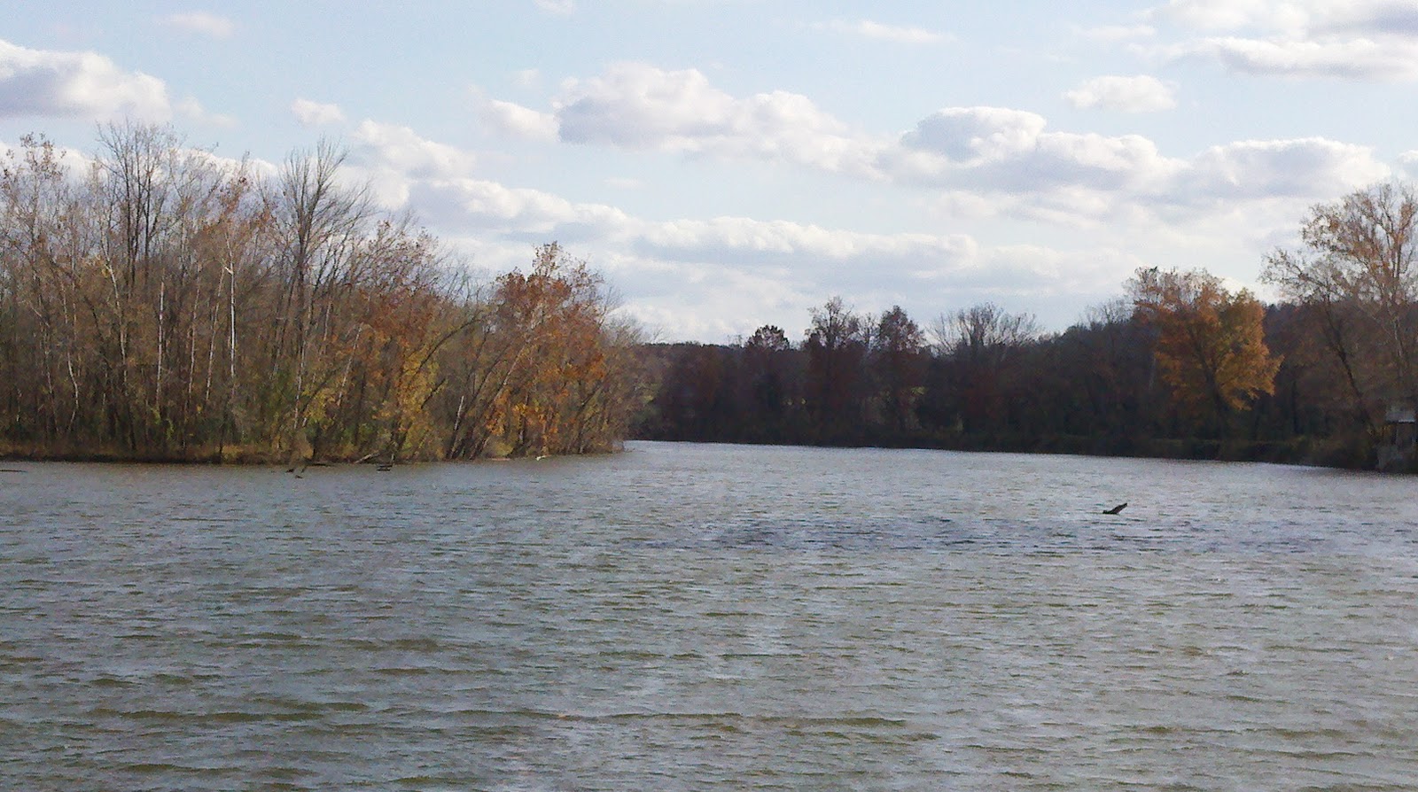
We have no seasons in southern California so it is quite special to be a part of the changing of the seasons here. Actually, it seems like we travelled south with the fall "blanket" all the way from Mackinac, MI where we first really started noticing the trees changing from green to reds and golds. It has literally been like witnessing a wave moving from north to south, and with that wave, fall unfolded before our eyes. Now, that wave has washed over us and the banks of the river have changed yet again. The trees have on their winter clothes now and their golden leaves have all but fallen, leaving bare branches. The banks are taking on several of the millions of shades of grey.

Moreover, the water levels are changing from summer to winter. The ACOE lets water out in anticipation of winter rains and storms. So, where you might have had 25 feet in the river, you now have 15. However, they have to keep enough water for the barges to keep running, so it's not a problem for us. However, every now and then, we come across an anchorage where the cruising guide says we would be able to get in, only to find it high and dry. We are not having any problems with water depth. I'm just noting it as a change in the season.

Yes, it has become a lot more cold, save and except for those balmy days in the mid 60's, and the weather is certainly less stable than it is in the summer time. Yet, I really like fall, and I really like the winter. When it's cold out at night, it seems so much more fresh and clean. You get this crazy fog on the water in the mornings that is loaded with ice crystals, and so it "hisses" as it skims over the surface of the water.

Certainly, there are fewer boats on the water. Most of the locals have "hung it up" for the season and have moved on to other endeavors. So, the waterways are pretty quiet. Others doing the Loop and many of the "snowbirds" are pretty much long gone by now. So, we have marinas to ourselves. We have local restaurants and bars to ourselves. We don't have to wait in line for the courtesy cars. And the locals who depend on cruisers for their economy are sure glad to see that there is one more boat. We are often asked if there is anyone behind us and our response is generally, "we don't think so." So, here we are, behind the curve, behind the crowd, and loving it. It means we get to pull out the winter sweaters, the Ugg boots, extra socks, and wool hats. We may take an extra day getting somewhere because the time change means it gets dark sooner, or because the weather suggests we should hole up for one more day.
We had a splendid trip back from Nashville, TN to Grand Rivers, KY. We spent a couple nights anchored up the Harpeth River, a place we wanted to visit since we passed it on the way to Nashville. The entrance is easy, and then you simply wind your way in. You have to watch for logs sticking out above the surface. I saw one chunk of wood protruding from the surface that looked from a distance like a green can buoy. Upon closer inspection, however, aided by a pair of binoculars, it was definitely the top end of a tree. The fact is simply that logs, dead heads, and tree knees are a part of life when travelling on rivers. You just have to pay attention to what you can see. You simply cannot worry about what you cannot see, although it is very important to have a working depth sounder and to pay attention to it.

We've seen some crazy things on the depth sounder travelling on the Cumberland. Sometimes the water is 80 feet deep 10 yards from the RDB, and sometimes it is 10 feet, 100 yards from the LDB. There is definitely a deep channel and it seems to almost always correspond with the sailing line. So, stay on the sailing line. I think I can sum it us as follows: I don't mind running in 60 feet of water, and I don't mind running in 10 feet of water. What I really mind is when it goes from 60 feet to 10 feet very quickly. This really gets your heart beating and is what happened on several occasions when you get into river bends. There is supposed to be this rule/assumption concerning deeper water inside the bend vs. slower moving water on the outside of the bend, or vice versa. However, it does not always work, and you should just stay on the sailing line. But, when you stay on the sailing line, you have to be prepared for some radical depth changes from time to time. It just happens.

Anyways, the Harpeth River is a very well used river among the local fishermen and reacreationalists. It is about as scenic as any river I have ever seen, if not more so. We anchored about a mile and a half up the river right under these very tall limestone sedimentary bluffsHarpeth River day or night. We could have stayed there longer, but we thought it best to move on as some more interesting weather was on its way.

The following morning, we pulled the anchor and moved on to Clarksville. We had been there before, so there is nothing exciting to report. We were, however, treated to a free night on the dock with electricity. Seems there was some confusion back in the Parks and Rec Office where there are folks who manage the city dock that resulted in the folks there simply saying, "sorry for all the confusion, we aren't charging you anything for the dock, so have a nice time, and call if you need anything." We certainly appreciated the hospitality and, for the record, the confusion I am referring to caused us no inconvenience or problem whatsoever. So, it was just a friendly thing to do.

The next day, we ran all the way from Clarksville to Hopson Creek and anchored for the night. With an hour less daylight available now that the clocks have been turned back for the fall, we have to be extra careful in terms of how far we run so as not to get caught out in the dark. There are no lighted aids to navigation out here and it seems that only every so often is there a nav aid that reflects radar. So, it is best for those who do not regularly run these rivers, to be off the water before sundown. We had a nice night, but, again, because of the weather that we saw coming, we thought it best to leave really early and make it all the way back to Grand Rivers (Green Turtle Bay Resort) before the weather.

So what about this weather? It was forecast as a steep pressure front that was anticipated to have been carrying lots of rain and thunderstorms. The steep pressure gradient promised a lot of wind. This storm had that for sure. It blew hard enough the last couple days to inspire a NWS Wind Advisory for the areas we were to cover before getting tied up at GTB. We got in a half a day before it arrived. Brenda and I were in agreement yesterday that getting here (GTB) a day earlier than originally planned was a good idea. Even on the rivers, as much wind as we have seen can push up a nice, closely packed 3-4 foot wind chop which, for us on this boat, is really more of an inconvenience than dangerous, but which would make things very dangerous if there were other problems. We like to anticipate and factor in "potentials" as an important part of daily micro-cruise planning. We may not know where we are going to be next week, or even tomorrow. But we sure as hell are prepared for what we will encounter today.

This reminds me of a discussion I saw recently on one of the cruiser forums I follow. The discussion had to do with cruising guides and the various avenues available to cruisers, from books to the most interactive resources such as Active Captain.com. It seems that there are those cruisers who rely on none of the above, but simply look to nautical charts for everything they need. Then there are others who maintain libraries of information on everything from restaurants in town, to what sort of dock they will be tying to. There are some who rarely if ever consult a guide, and others who spend all their time when they are not moving, in front of a computer screen tied to the Internet gathering information. I have even heard of some cruisers who rent a car and drive to the next marina they plan to stop at to check it out before they go there.

Suffice it to say that there are different kinds of cruisers who operate at different comfort levels, and for whom cruising means something completely different. For some, cruising is the science of discovering; for whom information is everything. For others, cruising is the art of discovering; for whom information is less important than discovering it along the way. I think we are somewhat in the middle. Any responsible cruiser should be fully cognizant of the weather conditions, the route for the day (including all the particulars), and where they plan to spend the dark hours. Then, a responsible cruiser will have at least one back up plan. Having a reasonable cruise plan requires the responsible cruiser to consult certain information before leaving, having considered the variety of resources available.

There is one thing I think would be very helpful that I have not seen on any cruising guide resource before. It would be very helpful if there were photographs of the dock, the river mouth, the marina entrance, the bulkhead, the whatever. Generally the reference to the anchorage is a mile marker. But, when the cruising guide references "mile marker 45.6" that is not always very clear. So, in my opinion, a photograph would be helpful. Again, there are those who might feel that even a photograph is too much like driving ahead to the next stopping point to check it out and stretches the limits of cruise planning reasonableness, but I think it would be just another resource to consider.

Realistically speaking, there are many cruisers doing the Great Loop who are experiencing their first boating experiences on the Loop; they bought their boat to do this and have never really gone boating before. They might have taken a few classes, and hired a captain for an afternoon to teach them how to dock the boat. Brenda and I, on the other hand, have been very active cruisers together for more than 20 years. On this boat, we have travelled more than 30,000 sea miles before this cruise. We know what she will do and what she will not, and we have the advantage and the benefit of total familiarity with the vessel. That takes a huge bite out of the cruising equation. All we have to do is figure out how to get it from point A to point B without damaging the boat or her crew. Easy, right? Sure. That's seamanship.

Well, we are awaiting the delivery of a new bilge pump. Ours is one of those very expensive diaphragm pumps and it seems to have developed a hole in the diaphragm. As the pump itself still works a little, but is more than 20 years old, I have decided to replace it as opposed to repair it. It's pretty tired. A bilge pump is an essential piece of equipment and it has to work. So, we have dropped a dime (actually several) and it will be installed before we leave the dock.

Speaking of leaving the dock, we will soon be heading south again only this time, it will be on the Tennessee River. We are still considering our options, but you can consider them all you want. You have to start moving. So, assuming we get that pump and get it installed, and get a break in the weather, we should be on our way tomorrow. Don't ask me where we will be going, because I have not figured that out yet. However, we will generally be heading south and will likely stop somewhere between 30-50 miles up the river as this is about the length of the stretch we are comfortable with in a day, and for which we will have daylight if we do not want to leave too early. Sure we could go further, but what's the hurry? It's already cold. Will it get colder? From what we hear it will. We both kind of hope to be part of a snowy day on the water. That would definitely be something we don't get to see in Southern California.
Bye Y'all.
Larry,
ReplyDeleteWe await your arrival up here in the Knoxville area. This is the headwaters of the Tennessee. The cruise from Scottsboro' Al to Chattanooga is as pretty as any on the entire loop. Will be nice to meet you and have 2Roughwaters pictured together. Check our blog for spots to stop. Jerry and Jenny Reves www.sweetgrassadventures.com
Hope Vanderbilt beats Tennessee this Saturday.
Jerry