Cayo Costa means Coastal Cay or Barrier Island. This is, indeed, what Cayo Costa is, a barrier island. The island is only accessible by boat. It's approximately 12 miles west of Cape Coral in Lee County and is a part of a chain of barrier islands that shelter Charlotte Harbor and Pine Island Sound. The island park is a little more than 2500 acres. Because of its position in an area of transition between the temperate southeastern coastal plain and tropical south Florida, the trees and bushes and other vegetation on the island is a complex mix which makes this place rather unique. The island contains a mixture of pine flatwoods, oak palm hammocks, and grassy areas interspersed with palms. The shoreline is dominated by mangroves.

For 4,000 or more years before the arrival of Europeans in Florida, a succession of Native American fishing cultures lived and worked in the Charlotte Harbor area. Several of their shell mounds are located on Cayo Costa. In the early 1800s, Spanish fishermen from Cuba established 'fishing ranchos' on islands along Florida's west coast. Fish were caught, dried and then transported to Cuban markets. A quarantine station was established on the northern end of Cayo Costa for immigrants entering the country through Boca Grande Pass in the late 1800s. Approximately 20 fishing families lived on Cayo Costa in the early 1900s, where they established a school, a post office and a grocery store.

The Cayo Costa Cemetery is located on Cemetery Trail, one of many trails within the park. Harbor pilot Captain Peter Nelson, who died in 1919, is buried here. He moved to Lee County in 1887 from Denmark when the shipping industry in the area was flourishing due to cattle and phosphate exports. His grave is marked with a stone that reads, "After Life's Fitful Fever He Sleeps Well." Another famous trail in the park is Quarantine Trail, located where the old quarantine dock and station once stood. These facilities were used by the U.S. military in the early 20th century to inspect men on board ships for yellow fever and other known communicable diseases.


To visit the island, you have to enter into Pelican Bay. This is where things get very interesting. You should come in here at high tide if you draft 4 feet or more. There is a very narrow area where there is enough water. We were not sure exactly where this narrow cut was, but we got in ok. Once in, we anchored in 6 feet of water in a good spot right in the middle and well protected on all sides. At night, we heard dolphin and manatee. Unfortunately, we did not see any manatee, but we knew they were there and swimming around the boat.
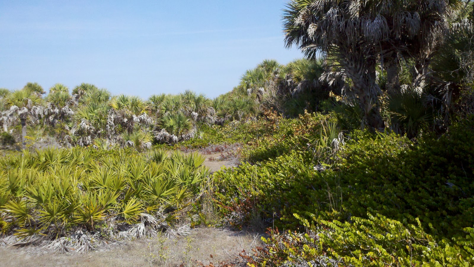
The following morning, we took the dinghy over to the park dock, and paid our $2.oo per person. We picked up a map at the ranger station there and took off for the Gulf side of the island. The trail was all white sand and crushed shell, and wound its way through thickets of trees of various kinds and shapes. I have always enjoyed places where the palms and the pines mingle together with the oaks and cypress trees. The ground is covered over with all kinds of grasses and palm sprouts. High in the trees, there were Osprey nesting and feeding their young. These are beautiful birds and a wonder to see in flight. We were able to creep right up under one such nest to shoot a photo.

We continued down the path to the beach and took off our shoes. It was an absolutely gorgeous day. The sun was shining, the breeze was warm, and it really felt sub-tropical; for the first time since we left, we found the weather we were looking for. I remarked to Brenda that, should there be an establishment similar to Doug’s Reef at Two Harbors at the end of this road, I’m staying!

We spent the next few hours combing the beach for shells. Brenda and I are getting pretty good at this and found some absolutely wonderful shells. If you slow down, you tend to find the better shells. Unfortunately, they dump tourists on this beach every day so perhaps some of the more rare shells are gone. Nevertheless, we had a great time. I found a drying puffer fish up at the high tide line. He is in great shape and is continuing the drying process on the eve under the bimini. I had to carry him for a couple miles because we still had food and water in the back pack and we didn’t want him stinking up the place. Eventually, however, he got into the backpack.

We then walked all the way to the north end of the island where we picked up another trail that lead us to the Cemetery Trail. This trail lead all the way through the middle of the north end of the island and took us back to the main road and the dock.


We’ll be leaving this place tomorrow. We had a really nice time here and thank our readers that gave us the recommendation. Tomorrow, we will be off to another place – not sure where yet. I guess I’ll figure that out when I get there. We have plenty of food and water and room in the holding tank to delay heading into a marina in Fort Meyers for some major putting back together and reprovisioning before we head across the state via the Okeechobee Waterway.
ST. JAMES CITY -
Let me take a moment to tell you about this little town at the south end of Pine Island near the junction between the San Carlos Bay and the Caloosahatchee River. The weather forecast called for north wind. As you know, we will not run at night and we try to wait for the tides. These two considerations often result in us stopping in places that most cruisers would not, given faster boats, local knowledge or simply, sheer nerve. First let me address the tides.
Getting into Cayo Costa was tricky. Getting out would be, too. We considered the directions explained by the Skipper Bob Guides, but, having been sitting there for a couple days watching other boats come and go, it became apparent that we did not follow the instructions as closely as we should have, or that the instructions were not as good and clear as they could have been.
According to Skipper Bob, when you are east/south bound, and you get to R72 at the north end of Cayo Costa, you turn to nearly 235 degrees (magnetic) and head for the end of the sand spit, then parallel the coast line in and, well past the park dock, you will find deeper water. Well, we almost did what this said. However, at the mouth of Pelican Bay at the north end of Cayo Costa, there are two sand spits, one north and one south. Additionally, they tend to overlap somewhat. Moreover, if you arrive at high tide which we did, you really cannot distinguish either of them very clearly. The NOAA charts are not that clear, either. There is a small cut on an 8 foot contour, but it is not clear where that contour begins and ends relative to the 2 foot contour just adjacent to it. So, we kind of slid in a little to far to the south and saw some very skinny water under the boat - like 8 inches to spare. This kind of thing settles on your psyche, and makes leaving a little more difficult. However, after watching boats coming and going at all different tides, with drafts equal to or greater to our own, we knew where we had gone wrong. When Skipper Bob says aim for the area between the two Manatee signs, what he really meant (or should have said) was aim for the area immediately adjacent to the northernmost Manatee sign. I also think that when he said parallel the beach 100 yards off, he meant 100 feet. On leaving, we learned that 100 yards off would put you in 3-4 feet of water MLW, while 100 feet has you in 6-7 feet at MLW. Thus, leaving was a lot less unnerving that arriving. Nevertheless, back to my point about the tides.
Since we decided we should make an effort to travel at mid to high water whenever possible, this sometimes means we cannot travel as far each day. We would simply run out of daylight. But that’s ok. It just means we have to study the charts a little harder to determine where to stop for the night. In conjunction with the Skipper Bob guide and the charts, we decided we would run as far on our way to Fort Myers as this place called St. James City. As I said, it sits on the bottom of Pine Island and affords excellent protection from northerly winds, which were forecast, and which, of course, never arrived. Anchoring here is like standing off in a wide open road stead. Yet, it is very pretty here and the water is like glass now that the south wind has stopped. (There is also a dense fog advisory until 10:00 this morning - visibility at the moment is less than 100').
We got here at around 4:00 p.m. in the afternoon yesterday. The cruising guide says there is a restaurant here, but that’s about it. How wrong! Yes, we did find the restaurant, but in order to find other things we needed before we got to Fort Myers, we had to hike a little, actually, not that far, and we discovered a very cool little town.
The restaurant is called “The Waterfront”. It is a very laid back, wood deck, tropical kind of place right on the water way. The town has lots of channels that run up and down, once you get “inside”. You anchor off the town outside the various markers that exist to warn you of the very shallow mud bank that protects this town. No problem, all very visible. Then, we hopped in the dinghy and ran between the markers to the channel that runs in front, and then turned right in the channel that took us to The Waterfront’s docks. We tied up and let them know we’d be back and went on a walk about.
There is one main road, called Oleander. As we walked up this road, we enjoyed how this town is so "old school." There are un-pruned trees and shrubs growing all over the place. It looks very tropical. It’s in its relatively natural state. Pines mixed with palms and other clearly tropical species, including mango and guava trees, growing amongst them. We even saw what looked like dropped coconuts in a roadside culvert. The road sides are white sand and crushed shell which crackles beneath your feet as you walk. There are no stop lights or stop signs. There are lots of single family homes and some condos, and there are a few trailers, but none of the high rise affairs we have become accustomed to seeing. This place looks like what Florida probably looked like 50-60 years ago. There is a General Store with a young girl working there who sort of looked like one of the monsters on the “Groovy Ghoulies” and who had the disposition of a prickly shrub. She was not unfriendly, she was just….. not. There are a couple marine stores and fishing marinas. This town is likely a destination for sportsmen looking to fish the flats and for tarpon and other particular species common to these areas. There were a couple brightly colored motels and a Baptist Church. Not much else.
Now you may wonder why this place has any interest at all. Well, it’s not Sarasota, and it’s not Miami, and it’s certainly not St. Pete’s. It’s not Fort Walton, it’s not Houston, it’s not New Orleans. What it is, is just a little place where people live. It’s a place where folks like us do not stop. It’s a place where folks sit on their porch in the afternoon. It’s a place where the local kids play in the trees, and the teenagers work on their cars under the carports listening to rock and roll music from the 1980’s. It’s a place where the best restaurant in town is the only restaurant in town. It’s a place where the fish really is fresh. It’s a place where the waitress is older, rather short, has really large breasts, and calls you “Honey”, and this makes you smile. You never meet a stranger in a place like this. It’s a place where the signs say, “I live where you vacation” and “If you drink to forget, please pay first.” It’s a place where everybody knows everybody. You don’t need a cell phone here. I am so glad we stopped here. Stopping here reminded me of just why we are doing this trip. It’s a little slice of America most folks would never even know about. But, I’ll bet someone grew up in this little town and went on to do something really big.
Today, we are off and on to Fort Myers where we will stay for a couple days in a ...….oh I hate to say it....….marina. We’ve been on the hook for a couple weeks and the batteries could use a good hard charge, the boat could use a fresh water wash down, the laundry will get done, and we will try to fill up our freezer again. This is what marinas are for. More importantly, however, Fort Myers is the home of the Edison Museum and Laboratory. I am really looking forward to this. Also, there is an art festival taking place down on the waterfront right near the harbor we will be staying in. Most importantly, we are staging for the crossing of the Okeechobee Waterway. This will take us clear across the middle of the State of Florida. This is going to take a bit of study. I want to make sure we do this right. It could very well be one of the highlights of this whole trip. There are locks and bridges, shallow water and gators. So, we want to be well prepared.
Bye for now.
No comments:
Post a Comment