Tuesday, November 30, 2010

TAYLOR BAYOU

Well, it's been an interesting couple of days.  We left Galveston and headed east.  It was nearly 60 miles to Taylor Bayou where we planned to stop for the night.  Originally it was our intention to leave the next day and move further east to Shell Island.  Well, sometimes, when you make a plan, God laughs.  So, you make another plan.  What was all that funnny? 

Well, we got anchored down and were having afternoon cocktails when my Android Weather Monitor beeped an unanticipated alert at us.  Yeah, we knew it was windy.  We knew it was a south wind forecast to blow 20-25.  Fine.  We also were aware that the wind was going to shift in the middle of the night to the north and blow 15-25.  There was a lot of rain. Fine again.  We know how to anchor this boat having done it close on 900 times since we got her so, we had out plenty of chain scope behind the fine Bruce Anchor that has never (knock knock knock) let us down.  The alert, however, was a TORNEDO WATCH!  Well I guess there is a first for everything.  Now, I quickly sprung into action to try to understand what this all meant.  What I was able to derive rather quickly was that we were definitely "in the zone" where the watch alert was issued.  There were barges pulling up onto the banks all over the area and nobody was moving.  Perhaps it was just because it was getting late in the day and they were tired after pushing all that corrosive, caustic, toxic, highly flammable benzine all day.  Then again, maybe they knew something I didn't.  My internet access didn't fail me at all and I was able to scan weather forecast information from a multitude of sights.  Still, I wasn't learning anything new. 

So, I took it one step further:  Is there a difference between a "watch" and a "warning"?  Yes, there is.  A tornedo watch is issued by the National Weather Service when they believe the conditions are condusive to the formation of a tornedo, whereas a tornedo warning is when they receive a report of one on the ground.  The "watch" was to last until 0300 so we decided to take anchor watches until 0300 and the cancellation of the alert.  No tornedos happened.  Oh well, it would have been cool to see one.  Rumor has it, they can involve winds of up to or greater than 300 mph in the center.  That is some serious God power.  Nevertheless, we did not do battle with wind.  In fact, the southerly breeze pretty much dropped off as the sun set.  Then, we did do battle with a cloud of mosquitos that hammered the boat.  It is important to remember when you are anchored in a bayou that, the mosquitos live here and were here first.  They attach right at sundown.  Fortunately, at around 0100 the northwind shift arrived and the temperature dropped to a little over 40 degrees F.  Between the wind and the cold temps, the skeeters split.  It's been cold all day and we haven't been bothered again.

So, it was cold and windy all day.   No tornedo watches, but massive grass fires were springing up to the southwest of us.  That's all we needed.  These fires kept getting bigger and bigger.  Fortunately, the wind was in our favor, but had there been a wind shift, we would have been F'd; not so much by a danger of flames (these were peat moss fires in grassland) but rather by smoke.  Again, I sprung into weather forecasting action and determined there was no real chance of a southerly shift, so we wouldn't get hammered by the smoke.  It's been a tough time here.  It's real pretty when things are good, but then the beauty is somewhat overwhelmed by the hazardous conditions involved in cruising the Gulf in winter.  I can honestly say that you had better be a sharp weatherman and good with an anchor, or you should stay home.


So the plan is to go all the way to Lake Charles, LA tomorrow, in stead of wandering into and anchoring in any more skeeter infested bayous.  This will be our first taste of Louisiana. I have some good leads on great cajun food, music and hospitality.  I am really looking forward to it. The weather forecast looks real favorable.  It will be a 67 nm run ( a long day ) and then we will probably go into the Bord Du Lac marina on the south side of the lake.  Rumor has it, it was just opened in September of this year.  Slip fees - $10 ($20 if you want electricity).  Whatever.

Anyways, that's all for now.  I'm tired and hungry after putzing around all day watching brush fires.


This was a pretty major grass fire.  The Port Arthur Fire Department says that these fires are started by the State or the Feds for wildlife management.  They burn for days and sometimes for weeks as they are burning the pete moss under and within the swamps.


Goodnight from Taylor Bayou Outfall Canal


Monday, November 29, 2010

We're finally out of Seabrook and eastbound again.

Finally getting out of Seabrook was quite a relief. We had a good time there despite the circumstances and made several good friends whom we shall always remember.


The old girl left Seabrook Ship Yard with a new pair of shoes.  She runs great now (even better than before)

We had a lovely Thanksgiving Dinner on board.  Brenda broke out the
finery and I did the cooking.


Even Runway (the white cat) and Tarmac (the other cat) were
offered some Thanksgiving turkey.


Runway got to sit at the table having promised not to sit on the
table and lick her ass.  Tarmac wouldn't commit.


A cool shot of a pelican taking off towards the back of the boat.

Leaving Seabrook - The Kemah Boardwalk
 Since we only had a 24 mile run to the Galveston Yacht Basin (GYB) we were able to take our time getting out. We left Seabrook at around 1100 after two pots of coffee and a good breakfast. The weather forecast was for smooth bay waters with relatively mild wind from the southeast, The forecast was right on. It was a fantastic ride.

When you leave Seabrook, you follow a relatively narrow channel into Galveston Bay across which you pass to the Houston Ship Channel which takes you all the way down to Galveston. It’s a wide open bay with plenty of water under the boat. One captain I spoke to commented that there was 15000 square miles of water averaging 6’deep. Where we were, there was between 9’ ad 11’. However, when the north wind blows, it tends to blow all the water our of the bay, so it gets even more shallow.
This was some of the heaviest ship traffic we have seen to date. The Houston Ship Channel is very busy, even on Saturdays. We encountered huge barges, tankers, ferry boats, sail boats, and dredges. There was the biggest dredge I have ever seen working in the Pelican Cut on the north side of Galveston Island. His AIS information said nothing about the name of the vessel or the fact he was engaged in dredging operations. Yet, it was pretty obvious to a reasonably experienced person that this was a dredge. Moreover, once you learn their light patterns, it is easy. You pass on the side where the green lights are, even though it might appear that you are passing on what would otherwise be the red side. If the lights are green, that’s the side you pass on. Did I mention the cruise ships also moving in the channel? The cut is over 40 feet deep in places. This cut is quite busy and getting into GYB was interesting. We had to dodge a cruise ship, a dredge, a couple sail boats, crew boats, a barge, and at least several small go fast fishing boats.
Check out how close this ship came to that barge on its starboard side.


Once we got into GYB, we found the nicest fuel dock we have ever been to. You need neither fenders nor dock lines. Both are provided for your convenience. You just pull up, step off, and tie the dock lines to the boat. It makes it a lot easier to cast off since you can do it from a position on the boat, instead of having to loose your lines and then step onto the boat after trying to push away. The way the dock was situated, the wind would push us off, if the wakes from passing vessels in Pelican Cut didn’t push you back on. Either way, we took on nearly 100 gallons. The price was only $2.86 per gallon. That is the lowest we have seen in months. It was nearly $4.00 per gallon up in Clear Lake, so it made sense to use a few gallons to save many dollars.

A view of Galveston Harbor - Pelican Cut from Teacup
After we got fuel, we anchored in a cove just outside the GYB in a place called “Teacup.” I have no idea why it is called that, but it is. The anchorage was off the main channel, but not by much. We felt the wakes of passing ferry boats and crew boats, but it was no worse than anchoring at the east end of Santa Cruz Island. In fact, if there was any roll, it was due to a wake and it would end as fast as it would come. It was nice and calm all night as all but the ferry boats essentially cease operations. The ferry boats sound horns when they come and go. If you lived on the water adjacent the ferry landing, this could become irritating. I once lived less than 100 yards from the railroad tracks. You get used to it and actually have to concentrate if you wanted to hear the freight trains passing in the night. We like the sound.

After we were securely anchored, we put the dink in the water and cruised it back into the GYB. The nice lady at the fuel dock let us tie up there so we could walk into town. You have to understand that Galveston is not terribly cruiser friendly. You really need a car there (or one hell of a pair of hiking boots) as things are rather far away from boat access. Nevertheless, we tied up at the fuel dock and took off walking. There was this funny lady at the guard gate whom we asked about whether there was anyplace for tired and thirsty cruisers to go nearby. She didn’t really have much to offer, but she pointed us in generally the right direction. So we headed south and walked across the island to the Gulf side and then turned right. The touristy stuff (Fisherman’s Wharf) was on the Pelican Cut side where the cruise ships dock. We did our best to avoid it. That was easy since it was 20 or so blocks to the west. So, we walked and walked. When we got to the Gulf side, we turned right and just walked up the beach.
Capital Q Texas BBQ - Highly recommended.
Since we got to Texas, we have been looking for a place to experience some of that great Texas BBQ. Well, we found a place right on the beach that was perfect. They had an outdoor bar with tikki torches and great outlaw country music – Nelson, Cash, Jennings, Haggard, etc. We had a lot of BBQ’d meats – sausage, pork ribs, brisket, etc. along with a tasty spicy sauce. That, and a bunch of drinks and, despite the cold and wintery weather, we were feeling pretty good. The walk home was interesting. One has to pass through some questionable neighborhoods if on foot. It all worked out and we got back to the boat at around 10:00. Overall, it was a great evening.


Part of the Shrimp Fleet in Bolivar Pass.
 We left Galveston this Sunday morning at 0745. We had planned a 56 nm run to a place called Taylor Bayou. It is rated as a good all weather anchorage. Once again, we had to transit the intersection of Galveston Bay, Pelican Cut, and Boliver Pass to get back to the GICW. Once we got into the Boliver Pass, things really mellowed out. The aforementioned intersection is open to the Gulf, so if there is weather in the Gulf, it is felt in the pass. We saw all kinds of evidence of Hurricane Ike while heading east behind the Boliver Penninsula. There were blown out homes and boats that had no business being that far inland with holes big enough to drive a truck through in their hulls.

Near the east side of the Boliver Pass, we passed by the town of Stingaree. No reason for it to exist, but it looked like a cool little place with lots of bulkhead one could tie to if it got late. Then there were miles and miles of straights. Course corrections involved 1 to 2 degree changes. It was pretty much like this all day.

The barge traffic all day was pretty intense. There were at least three occasions where we had to simply hold position behind a barge moving 4 knots while we waited for another barge coming up to pass before we could ask for an outbound pass. One such instance was Rollover Pass. It’s pretty narrow there. You come out of the protection of the marshland and then have to cross a small body of open water (Rollover Bay - the south side of East Galviston Bay) and then make your way between the marks. It’s like 1’ deep on either side of the marks, but 16’ straight down the middle. We held position behind a barge, while two others were coming side by side through the pass. Clearly there was some passing going on as we could hear them talking on the radio. There was no fitting in there, so we waited. When they both cleared, we followed the other barge through staying right on his transome to ensure deep water. Afterwards, we asked permission to pass and were granted. I have said it before and I will say it again, the tug captains are really very nice, for the most part, and will actually move their rigs over for you to make it easier to pass. We make it a practice to always contact the skipper and ask permission to pass on one side or another. Yeah, you better know your whistles around here, so when they say, “Sure you can run on by on my 1 whistle” or “Push on by my two” or “Keep-a-comin’ on the one” you know where to go.

Some of the barges carry some pretty heavy duty chemicals. We saw at least 4-5 barges carrying hundreds (if no thousands) of tons of Benzene. I’ll tell you that, if one of those got loose, it would kill everything within a 50 mile radius. The Gulf Coast is refinery land. It might be easy to complain, but think of it this way: The stuff could all be made in China or somewhere else and then we would pay for it to be imported. Also, if you like your nonstick pans, efficient burning gasoline, plastics, pharmaceuticals, etc., you have to accept the fact that the stuff has to be fabricated somewhere, so it might as well be here where lots of folks can work and townships can thrive.
Those are actually donkeys on this spit sticking out in Willow Bay,
So we pushed on and on, on very straight waterways all day. We passed through grasslands, bayous, sloughs, marshlands, and everything else otherwise natural preserve land. It was quite beautiful. We haven’t seen so much as a hill down here. It’s kinda strange. We did get to go under the High Island Bridge, however. Way the hell out in the middle of nowhere is a bridge with a 73 foot vertical clearance. I don’t know what is on either side, but it’s there.

One really funny thing happened on the radio. Per usual, I would announce our presence to a barge in sight, using the vessel’s name as derived from the AIS. I would generally refer to us as “the white power vessel …..” Some character comes back as says, “White power vessel? That’s not very PC now is it.” It never occurred to me. There then ensued a conversation amongst unseen barges over whether we were a power vessel, a motor vessel or a pleasure craft. I guess it took us a while but we didn’t even think of the “white power” thing. Well, it was all pretty funny. Since that time, we have been referring to ourselves as “the pleasure craft”………

We saw this barge and though of our nephew, Brian Paul Donovan
Did I mention the bottom composition around here? When we pulled the hook in Galveston this morning, up came the gangliest, blue-black, oozy mud I have ever seen. What a mess on the bow! I have to engage a wash down pump up there or we will be completely covered in this ooze. Not to mention the fact that the anchor locker will be thick in it. The holding is really good, however. The old Bruce just digs in and sets immediately, burying itself in the process. This morning my windlass was pissing and moaning trying to pull out the hook, the mud is so thick. So we decided not to stress it out so much and used the boat to pull it. I was rewarded for my effort by globs of gooey, foul smelling, sticky, oozy mud all over the front of the boat. There is rain in the forecast (again) so it’ll get cleaned. I just hope it rains hard enough and long enough that it does not merely spread all the nastiness. It’s all good.

This evening, we anchored in Taylor Bayou. Actually, to be more accurate, we anchored in the Outfall Canal of the TB. You come off the ICW just short of mile marker 290 (WHL) and turn left. You go up about ¾ mile and then make your way through a fairly wide opening in the grass and then you are in this canal that was definitely man cut. It is quite wide, and the depth is 15 feet all the way back for the next 2 miles. We just went back around ½ mile as it is a bayou with nothing to do but sit and wait until you leave the next day. Once again, we are anchored in that gooey mud. However, it’s a good thing. Not long after we anchored, my Droid beeped a weather alert at me. Some rather high winds and thunderstorms are forecast for the next 24 hours. I let out more chain. We are sitting in 15 feet of water over gooey mud with 110 ‘ of chain out. We’re not going anywhere.

Around here, the wind is steady and fairly predictable (trade winds usually are). But, the shifts are dramatic. The NWS will say that there will be wind from the south in the morning and then from the north in the afternoon. Well, right at around noon, the south wind slows down and then stops, and the north winds fills in slowly, and then becomes steady and holds. The NWS around here has its act together. I think they are better at forecasting weather. In California, since we never really have any weather to speak of, I think the NWS gets lazy. It’s an old joke in California that when there is a 30% chance of rain, what that really means is that there are 10 guys in the NWS weather center and three of them think it might rain. Here, however, in the land of hurricanes, tornadoes, trade winds, and major shipping, I think there is a better quality of weather forecasting because so much depends on it.

At this point, we are only around 36 miles from Louisiana. From Galveston to Houma, LA, you really have to do some cruise planning since the anchorages are few and relatively far between and there are no marinas for a long ways. So, when you get into a good anchorage and you get a weather alert, you had better be in a place where you can stay put for a couple days until the weather passes. Keep in mind that on the GICW, there is no serious fetch to speak of, so when it blows, it does not really cause waves, which as some of you know, is much more of a concern for anchoring than the actual wind that creates the waves. However, when travelling on the GICW, you have to cross a number of lakes along the way. This is where it can get tricky when there is a lot of wind. Most of the lakes around here average 3-5 feet deep. This means that wind blowing over this relatively shallow water can do one of a couple things: In Galveston Bay, for instance, when the wind blows hard from the north, it pushes water out of the bay and the water level literally drops a couple feet. There are marinas in the back of Clear Lake where boats simply cannot get out because they are stuck in the mud when the norther blows. Also, you can imagine how the waves can get pretty dangerous in such shallow water. They are packed together and steep. The wind also blows marks off station so it is not uncommon to see a red marker well out of the water on the green side of the GICW. Always fun. For instance, there is a place called Rollover Pass on the way out of the Boliver Penninsula Cut where there is a really big jog in the waterway. It is unclear whether there is really a jog in the cut r whether the marks were blown that far off station. The best advice I can give anyone is to follow a barge through if possible.

So, here we are in the Taylor Bayou with a wind storm from hell bearing down and fixing to hit us tomorrow all day. We have snakes, gators, blue black mud; we are in the lights and shadows of the refinery hell that is Port Arthur. Sounds like paradise, right? Well, I guess it depends on who you’re with. It’s paradise all right. We’ll plan to stay put until Tuesday and let it pass before we move on to our next stop, Shell Island in Lake Sabine (just shy of the Louisiana line) if the norther that is coming behind this one doesn‘t change out plans.

By the way, if you have any questions about anything we are doing, please do not hesitate to post them. I will be glad to answer them.


Thursday, November 25, 2010

Seabrook on Clear Lake (Still in Texas, but not for long)

Well, it's rather early on Monday morning and I can't sleep.  It got very warm and humid yesterday after being otherwise nice and cool and breezy for the past few days.  If the past reflects the future, we will have rain in the short term. 

We have been here for almost a week getting fixed up.  Abreojos is almost ready to go.  We are awaiting a single element and we can be moving again.  The timing of all this is interesting.  It would seem that, as soon as we are ready to go back into the water (hopefully) a storm is slated to arrive.  Then there is the holiday.  We need fuel.  To get it, we will run 25 miles back to the Galveston area as it is very expensive in Clear Lake.  I guess when you are the only game in town for 25 miles, you can charge a little more and get away with it.  So, if we go in the water before thanksgiving, we'll hang out here until the weather system passes.  It's a cold front bringing very cold air from Canada all the way down to the Gulf.  I know it seems kind of ridiculous to have 82 degrees on Monday and then 34 degrees on Thursday, but that is how it's looking. Roasting a turkey aboard all day will keep it nice and warm in the boat.

This has been a great stop.  I have said that, had it not been for the stupidity associated with the use of fixed marks to identify the location of a constantly changing and moving sand bar, we might never have come to the Clear Lake area.  It reminds me of the Fish and Wildlife Service designating "no fish zones".  Hell, the damn fish can't read the signs!


Post Continued 11/25

We have been in Seabrook, Texas for a little over a week now.  Most of you know how we ended up here.  When I say “ended up” I don’t really mean that in a bad way.  It’s just a function of circumstance.  Had the sand bar not been a moving target between fixed marks, and had we not tried to get off at low tide, we would never have come here.  In terms of making further connections, we can also say we never would have met Rodney and Mattie, or Terry and Lauren.  We never would have gone to NASA.  We never would have gone to the Kemah Boardwalk.  We never would have eaten Gator nuggets and frog legs, and we never would have gone bowling with our local friends.  There are always lots of things you never would have done had you not been in a certain place at a certain time.  What you always have to do when faced with adversity is first, deal with it, and then look for the good in it.  I could complain about having to stay in the boat up on blocks in the ship yard.  But then, we could have been stuck in some industrial area down in Galveston and not here in this lovely suburb of Houston.  The bottom line is this:  one is never “stuck” anywhere.  We end up in places for a reason.  We don’t always know the reason at the time, but somehow it becomes clear.  I am not espousing a destiny theory.  Rather, I think I am just saying that it’s always possible to find a reason and then it’s what you do with it that counts.
So, for the first time, our AGLCA membership made a difference.  As you know, we now fly that burgee on the front of the boat (just over the cow skull).  A really nice couple, Terry and Lauren, came by the boat and said they were also members and recognized the flag.  It turns out, these were two of the nicest folks.  We had happy hour on the boat last night and they joined us.  Having done the ditch numerous times, Terry was able to really regale us with information that will be important to us as we continue to move east.  In fact, they will be returning to their boat in the Fort Meyers, FL area in January and spending the winter in the keys.  In all likelihood, we will run into them again.  I sure hope so.
Rodney was the Tow Boat US skipper that came and first pulled us out of the mud, and then brought us up here to Seabrook.  I had a great time chatting with him in the boat yard.  We went out to dinner with he and his wife, Mattie, and their friends Don and Donnelle.  We went to a cool place near the boardwalk and then went bowling.  What a difference air conditioning makes.  The bowling alley was quite well air conditioned.  We are getting used to the heat and the humidity.  We had a great time.  I actually won the first game with a pathetic score of 138.  Then again, I haven’t tossed a bowling ball for nearly 20 years.  It was a lot of fun.  Even Brenda had a good time.  The gutters got polished as a result of her effort for the most part, but she managed to throw a couple “X’s”, too.
As I have said, we were treated quite well by the owner of the marine service and the folks who work there.  There is one person in particular, however, for whom I have the greatest admiration.  His name is William.  I don’t know his last name.  He is very soft spoken and quite mild in his personality.  He called me “Sir” all the time in spite of my best efforts to get him to call me by my name.  Nevertheless, this guy is one hell of a “wrench.”  He had this way about him – total competence.  He knows boats inside and out.  He knows all boats.  He would work on ours, and then go work on another.  He might be working on several at the same time.  All different projects.  There was nothing he could not do, whether it be changing the props and shafts on an 80’ Donzie sport-fisher, or installing a bow thruster or stabilizers on a 70’ Choi Lee.  This yard handles the big boats and he is in charge of all things mechanical.  Outside the yard, he owns a trailer park.  He takes care of his aging mother.  He told me of how she recently shot a 35 lb cat fish and nailed it to a tree.  Boy was I impressed.  I jokingly told him of how my own mother’s idea of camping is pitching a tent in the lobby of the Beverly Hills Hotel, and that she and guns simply do not mix.  He then commented that he was impressed with his mother’s use of the 30-30; that that’s a big gun for a woman.  He is the epitome of how life is so different in so many places.  He grew up building and working on boats, working in the chemical refineries, fighting in Viet Nam, and then returning home to Cajun cooking and life in the bayou where he was raised.  There are characters in movies like this guy, but he is for real.  I enjoyed working with him.  He is a fine, stand up guy whom I shall always remember.
NASA was a blast (pardon the pun).  The tour and the facility are gauged for 6th graders.  It was quite cool, however, to see the real mission control and the facility in which astronauts and engineers train for work on the shuttle and at the International Space Station.  We had a nice time.  Houston Space Center is only 6 miles from here so we rode out bikes.  The weather was perfect. 
We are now floating again and tied to the work dock at the ship yard.  Now that we are no longer being worked on, we have to pay for the space, but who can really complain about $20 per night including electricity and water.  We plan to leave this place on Saturday.  What is really nice is that we are having Thanksgiving aboard – just the two of us.  I was up really early getting it all together.  I baked a pumpkin pie, prepared and roasted a turkey, stuffing, yams, green beans, rolls, etc.  All the good stuff.  You cannot believe the smell.  It smells like……the holidays.  I guess it’s the season.  We’ll be moving along towards Louisiana on Saturday.  We have to get fuel, so we’ll head down to Galveston where the cost of diesel is significantly less.  Then, we are going to take our time over the next 200 miles, moving slowly from place to place and then staying in places for a couple days – if it suits us.  We decided it is more important to take our time than to get any place in particular by any time.  We have no schedule, only a goal – to complete the great circle route.  It seems like a tough mission.  We’ll make it.
With all that being said, Brenda and I wish you all the best this holiday season.  Eat too much.  Spend too much.  Love too much.  Indulge.  As Erma Bombeck once said, “Life is uncertain……Eat dessert first.” 
There’s a storm coming in tonight that promises a lot of wind and a lot of rain, so I have to get this old girl buttoned up for the blow.  We are in a safe place and not going anywhere until the front passes.  Saturday promises to be glorious Gulf Coast weather.
Bye y’all.

Friday, November 19, 2010

JUST AN UPDATE.....

After we got towed to Offetts Bayou, we discovered that our steering problem was associated with a broken rudder quadrant.

This is what is known as the "quadrant".  It is connected to the steering wheel by a series of chains and cables enabling the rudder to turn which is what gives the vessel directional control.  In the upper part of the photo, you can see what appears to be a square shaft sticking up from the top corner of the quadrant.  This is actually the top of the rudder post.  The quadrant is a two piece affair connected to the top of the rudder shaft.

It is the backing part of the rudder quadrant, the part that holds the quadrant to the shaft that broke.  I know it's hard to tell, but that backing piece is over and inch thick in all directions and is made of solid bronze.  I am still wondering how it broke, but it did.

So, we got towed again.  Originally, we discovered a yard in the Galveston area that could haul our boat.  After discussing it with the Boat US tow captain that came and got us, he strongly recommended against that yard and offered to tow us up to the Clear Lake area (only 23 miles up the Houston Shipping Channel) to a yard called Seabrook Ship Yard.  He told us that the yard in Galveston was in a highly industrial area and in a bad neighborhood.  We would have nothing to do there and would not feel comfortable at night.  He was absolutely right.  Seabrook is a very nice suburb of Houston.  The yard is completely modern and clean.  They are very busy here, but the owner, OJ, has done a lot of cruising and is sympathetic to our cause.  We were towed in Monday afternoon, hauled first thing Tuesday morning, and the problems dissassembled and diagnosed within 3 hours.  All parts are on order, and we hope to be out of here by Tuesday or Wednesday of next week.  We have been allowed to stay on the boat, and that's fine, but we would prefer not to spend Thanksgiving in the boat yard.

The damage was pretty extensive.  First, of course, is the quadrant.  But what happened after we ended up in the mud was much worse:  bent shaft, bent rudder, and damaged propeller. 


It can all be fixed and is in the process thereof.  The shaft is a problem because it is some funky metric size and is being custom made.  Thank God for insurance.....that's all I have to say.

In the interim, we are having a good time.  It sucks, but the folks here could not be nicer.  We went to NASA yesterday on our bikes and had a blast (pardon the pun).  It's going to all work out.

That's it for now.

Monday, November 15, 2010

Port Lavaca to Galveston - Sometimes, you just have to go "commando."

Port Lavaca to Galveston

This is the collection of shells combed from the south shore of Matagorda Island
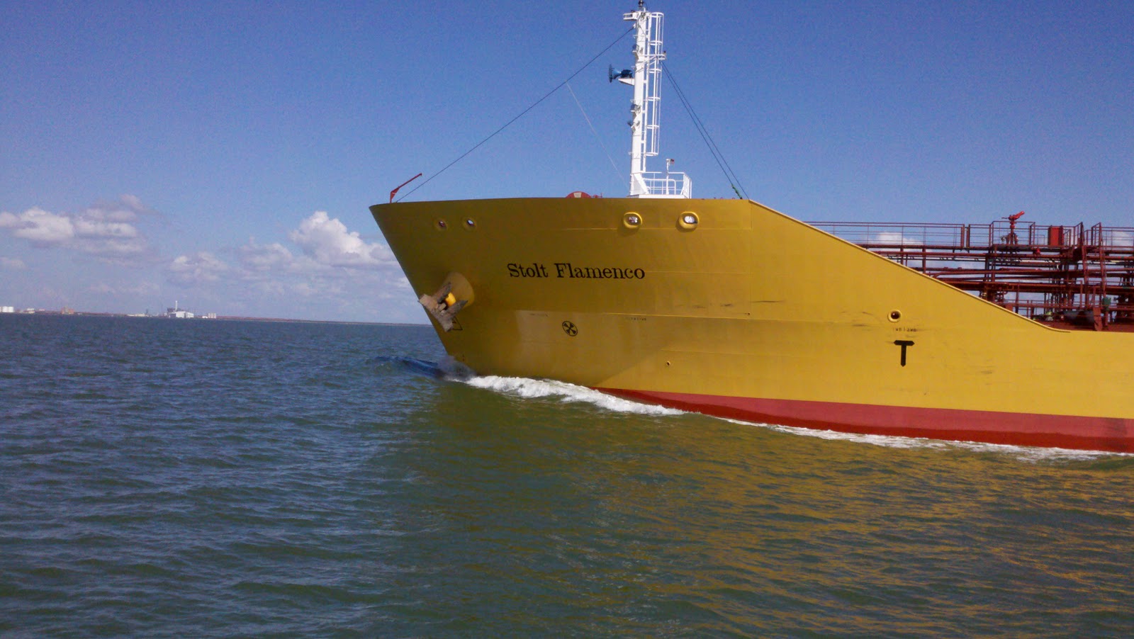
The trip from Matagorda Island to Port Lavaca was uneventful, if you consider being passed in the Matagorda Ship Channel by a “partially loaded chemical tanker” uneventful.  Before making this 32 nm run, I was aware of the Matagorda Ship Channel.  At the top of Matagorda Bay is Port Comfort which is the home of a massive refinery complex.  Well, making all things wonderful out of petroleum products requires chemicals.  They’ve got to come from somewhere.  Around here, most of the refinery activity is on or near the water, so much if not all of the refinery products for production or final product are shipped by water; i.e. barges or tankers.  Sometimes, the tankers are barges.  We have seen what look like floating refineries being pushed down (or up) the GICW by tugs.  Some of these things that look like small refineries are very big indeed.  I recall a conversation with a tug captain I had on the way into Matagorda Bay.  I called him on the radio, having identified him on my AIS, and asked him what side he wanted to pass on.  He said, “your preference, skipper.”  I said, “Oh no, please.  It should be your choice.  You’re the one pushing what looks like a small refinery.  Me?  Hell, I’m just hauling my wife, two cats, and a case of warm beer to Galveston.”  So, he said, “Ok, Captain, we’ll see y’all on the two.  By the way, is that an old Chris Craft?”  Yada yada yada.  We had a nice conversation.  Anyways, my point in all of this is, we were aware that shipping in Matagorda Bay is important and that there is definitely a shipping lane.  All boats, however, share this lane.

So, I see this guy on the AIS and I know he is going to Port Comfort.  So, I picked him out on the radar when he was three miles behind me.  Then as he got closer, about 1.5 nm, I called him (since he hadn’t called me).  First I spoke with a guy with a distinctly foreign accent.  He was not the captain of the ship as these folks pick up Bay Pilots at the jetty entrance to Matagorda Bay.  I told him that I was about 1.5 nm ahead of him and that, based on his speed and mine, he would overtake me before the intersection or split between the Lavaca Channel and the channel to Port Comfort, and what did he want me to do.  He said, he would talk to the pilot and get back to me.  Some 3-5 minutes later, I get a call on the radio from the pilot.  He tells me to just, “slide on over to the green side” and he will have plenty of room.  “Sorry I didn’t call you earlier.”  So, I slid on over to the green side and otherwise held my course and speed.  
It took him a while, but just as we were both approaching the “Y” split, he passed me. 
Now, you have to understand, we are used to ships in shipping lanes having been crossing the Santa Barbara Channel for many, many years. 
However, we are generally weary of them and make it a point to keep a vast distance between us.  Moreover, we have rarely, if ever, successfully communicated with anyone on the bridge of one of these big ships. 
So, I have to tell you that being passed on my starboard side close enough to reach out and spray paint the name of my boat on the side of this one was a little interesting.  I mean, heck.  It’s not every day you get passed by a 465 foot partially loaded chemical tanker who tells you to drive on the wrong side of the road so he can pass, right?   

When we got to the split, he had to make a hard right turn.  When he did, he was less than 50 yards in front of us.  The rear end of that tanker swung out like nobody’s business and as he did so, he had to goose the throttle and, boy let me tell you, he sure kicked up a lot of mud.  The water turned from grown green to chocolate milk all around me and my depth sounder went “nutso.”  I knew we were in plenty of water, but the sensors picked up all that kicked up mud and must have really enjoyed telling me my depth was 1.8, 2.2, 1.5, 2.5 feet for a couple minutes there.  Then, of course, it cleared back up, and the sounder went back to 33’.   What a day!
So, we made the turn and slid, and I mean slid, into Port Lavaca.  I had been on the phone with the Harbor Master, a really nice fellow named, Ron.  I told him what we had, he told me what he had, and we agreed that he would meet us out on the end of the pier to wave us in (not uncommon in these parts, from what I hear.  Can you imagine the Harbor Master at Channel Islands Harbor actually getting out of his chair to aid a boater coming into the harbor?  NEVER HAPPEN.  As we concluded our phone conversation he said, “Don’t worry, you won’t miss me, I’ll be the fat guy out on the dock!”  You just have to understand how funny this sounds in a thick Texas drawl. 


 As we got into the harbor, and I think we left a corn row on the way in, he was there with several dudes he rustled up off the docks to help with the lines and to get us into this seemingly impossible place.  They did a great job and we were in, safe as a bug in a rug.  As soon as I had a chance to get off the boat, I shook his hand and thanked him.  He said, “The first night’s on the house, and after that, multiply the number of nights by $20 and if I’m not around, leave it in an envelope and shove it under the door.”  Oh yeah, right, like that’s going to happen in Ventura or any marina in California.  Nope, Texans have shown us wonderful hospitality at every turn.

Actually, when we arrived in Port Lavaca, Brenda uttered the words no boat captain ever wants to hear, “Hey Larry, there’s water in the v-berth!”  Oh Shit!  So, I go on down to take a look see and what did I find?  There was water in the v-berth – “a whole lotta” water in the v-berth – like, it was an inch deep on top of the floorboards.  First things first.  Any reasonably competent captain knows that the first thing you do when you discover water on board (water belongs OUTSIDE THE BOAT) is you grab up a big handful of it and put it in your mouth.  Is it salty?  Is it fresh water?  Did the holding tank rupture?  (yuck)  You have to do this to know whether you sprung a leak or whether your fresh water tanks are leaking.  Well, after doing this a couple times, I couldn’t tell, but I was pretty sure it was salty, but it was not that salty.  In any event, diving into a hot engine room and pouring through every small nook and cranny on the boat looking for a leak was not fun.  In all cases, I could not identify a leak.  All through hulls were sound, the main engine water pump, exhaust, rudder packing, shaft seals; all appeared to be sound and showed no evidence of a leak.  All hoses were fine. 
What we did discover, however, is that our bilge pump was clogged.  A screw had lodged itself in the hose and functioned to capture small amounts of debris and ultimately clogged the hose. We have a shaft seal that is supposed to drip.  This is what cools the shaft as it turns at 1600 rpms for hours and hours.  Normally, even after a long run, the bilge pump removes any water from the bilge.  It even has a float switch so it happens (or is supposed to happen) automatically, as it should.  In the end, Brenda and I could only surmise two possibilities:  One, is that the drip from the shaft seal was always there and there was water in the bilge from weeks if not months ago that was not visible to the eye, and, although the bilge pump sounded like it was working, it was not, and after a final 35 mile run, it just flowed into the v-berth and that was it.  Two, because it was so much water, and it was not all that salty, it might have been a strange accumulation of rain water since it rained so hard before we left Rockport, and again, it was unseen, and the bilge pump, although it pumped its little heart out, was not actually clearing anything because of the clog.  Those of you who have boats know that drips in one part of a boat may, in fact, be coming from a leak at a completely separate, far away, and disparate part of the boat.  In coming water, makes its way in the strangest way to the strangest places and finding that leak is almost impossible. 
All’s well that ends well, however.  We “MacGyvered” a spare bilge pump, some wire, a plug for a cigarette lighter, and 20 feet of hose we picked up at the mercantile, and pumped all the water out quite quickly without having to use a hand pump and buckets.  The other option would have been to have a party on the back deck.  This way, we would have plenty of extra weight on the boat to cause the water in the forward compartment to seep back into the keel where it otherwise belongs so the newly refreshed bilge pump could pump it out.  Since there was a hardware store nearby, we changed out all the hose on the bilge pump system and now it pumps water like a marathon runner.  Since then, the bilge and the v-berth have been bone dry.  So what happened?  No idea.  It just rained like the hammers of hell last night.  So we’ll see if there is water in the v-berth in a day or so (got to give that mysterious leak time to get there).
There really is no reason to visit Port Lavaca.  It definitely is not a tourist town.  It is a place to provision, however. It would appear that Port Lavaca serves the refinery industries in the area.  There is a hospital there (the only one between Galveston and Corpus Christi.  There is a HEB, a Bealls, and all of the other chain-style places you see in just about every other small coastal town in Texas.  There is a Subway, a Sonic, a Whataburger, a Popeye’s, a Pizza Hut.  There is a Radio Shack, a few scattered tax preparers, and, a photography studio. 
You know high school is a big deal in Texas.  Graduating from high school is a serious accomplishment in these small towns.  Generally, I think going to college is not something most kids finishing school think about, unless they are athletes.  Now, that, they take seriously.  The football stadium in Port Lavaca is bigger than those found on most college campuses throughout the country.  Every Friday or Saturday night, for several weeks in the fall, the entire town goes to the game.  They have to have seats for them all, or most of them. 
One of the more interesting things I saw in Port Lavaca, however, was a law office that specialized in mesothelioma claims.  It made sense given the proximity to major industry.  It was disgusting!  These leaches actually go in search of victims of asbestos exposure and sue the same industries that give life to these little towns because they know they can make a buck and get away with it.  It’s not like this is going on now.  These unfortunate folks were exposed many years ago when science was not all that familiar with asbestos and what could happen.  I’m not saying it’s a bad thing that this circumstance has been fixed.  It just seems to me that profiting off someone else’s misery is not entirely moral.  Those of you who know me, know that, given the opportunity to crap all over the legal industry, I would do so for days.  It sure gave me a lot, but it sure took a lot too.  I’m finished with it.
We had a wonderful time at a place called Tropical Gardens.  It was a short bike ride away.  There, they serve beer in buckets (6 bottles per bucket, all covered in ice.)  Brenda drank wine.  The fried shrimp and fried oysters, along with the fried eggrolls, fried Jalapenos, fried chicken wings, and fried “whateverthehellelse” was on that platter, sure was good.  It occurred to me that, hopefully, the hospital nearby has a really high quality cardiac care unit that specializes in angioplasties and placement of stents, given all the fatty fried foods many folks eat down here.  The idea of a fresh steamed veggie on a plate does not seem to resound very well.
We actually went to Port Lavaca because it was a place where we thought we could have Brenda’s contact lenses shipped with relative ease.  So, we made those arrangements before we got there, and of course, when we got there, the lenses had not.  This meant we had to wait another day.  We didn’t realize that the second day was Veterans Day and there definitely was no mail that day.  We spent the second day doing boat chores and laundry. 
As they say, sometimes, the hits just keep coming.  Later that night, we were chillin’ (well not really since it was well over 80) on the boat, doing laundry, watching tv, working on the computers, and doing some final boat chores before our planned departure in the morning, when I detected the distinct odor of burning rubber.  So I think to myself, great, the belt on the washer/dryer is going.  Then, I said to Brenda, “Are you baking cookies?”  Then, after a reasonably quick search, I determined the source.  We were burning up our ship-to-shore connection.  So, we shut down everything.  After a little research, I discovered the problem.  It’s called, or referred to as, a “loose neutral.”  Normally, the wires can handle the loads, but if there is a weak spot somewhere along the line due to a loose wire or corrosion on a wire, it can heat up due to resistance associated with this weakness, and can cause a fire.  At first I thought it must be the harbor’s problem.  I looked in the dock box and saw an electrical box with a breaker that looked older than me that was laden with hornet mud nests.  I later determined that, from an inspection of the boat side of the AC shore connection, it was the white wire, or the neutral, that was melting.  The weak spot however, was a corroded neutral “pin” in the shore cord.  So I have that to fix now as well.  What is the lesson in all of this?  Yeah! I get to go shopping at West Marine!  No, seriously, MAINTAIN YOUR SHORE CORDS!  No longer will the cord be nonchalantly dropped on the deck and left there.  This piece of equipment is probably the most taken for granted and one of the most notorious causes of fires aboard boats seemingly safe in their slips. Normally, when the boat is just sitting there plugged in, it probably will not be a problem.  However, if you put a load on it, it will be a problem. It’ll get fixed this week, before we plug in again.    There goes another $200 bucks.

Caney Creek (pronounced "crik")

We left Port Lavaca early the next morning.  Our goal was to make it to the San Bernard River.  However, because of currents and barge traffic, and a slow passage through the Colorado River Locks, we were not able to make the speed that would be necessary to get us to this river mouth before dark.  Additionally, there was weather on the way and I decided that, first, I did not want to attempt to anchor in a strange river mouth after dark; and second, I did not want to be anchored in a river mouth if there was going to be a lot of rain.  Logical, yeah?  So, having done our homework, we had a bailout plan, and we stopped for the night on a free dock at a park in a place called Caney Creek, three quarters of a mile west of the Caney Creek swing bridge.  It was a very nice place.  We could hear the surf on the gulf. 

Caney Creek waterside park.

This is what we had to tie to at Caney Creek......but it was free.


Although we only wanted to stay there a night, we ended up spending two.  The north wind kept us literally pinned to the dock the following day and there was no way in hell we were going to get off without risking serious damage.  So, we stayed put.  It gave us a chance to catch up on some reading and I got to put together the video of our passage through the Colorado River Locks.
 
Here we are following this barge hauling 8000 tons of butane into the Colorado River Lock.

We left Caney Creek, bound for Galveston.  76 miles.  It was an otherwise uneventful trip.  76 miles with a 20-25 knot wind on the nose the entire way.  Not that we were uncomfortable.  It was just cold and dreary out all day.  The sun never came out. 

On the way to Galveston, we passed through the small, but highly industrial town of Freeport Texas, aka "Sulphurtown".

Not sure what they make here, but it looks imposing

Not a warm and fuzzy place at all.


Ships docked and unloading.


Dry storage for boats - 5 decks high.  Love how they make the building look like a townhouse complex.

Old Casino Boat - wonder if it still moves.


The Galveston Bridge


Then it happened. As we were in the shadow of the Galveston Bridge, and less than a mile from our planned anchorage in Offetts Bayou, we had to navigate some tricky markers.  All of a sudden, the steering basically went out.  I could turn the wheel  - literally spin it – and nothing would happen, at least it was no where near as responsive as it should have been and we bumped the muddy bottom.  Obviously, I tried to turn, but I guess we got just a little out of the lines.  The lack of steering distracted me and I found myself heading for RN8 instead of RN6.  When we touched the bottom, the boat spun a bit and then the wind caught us.  We were stuck like a fly in molasses.  We tried to get off, but we were stuck and the steering was no good. So we shut ‘er down.  We first inspected for leaks.  We found none.  We then called Vessel Assist (Boat US).  The Coast Guard heard us calling and relayed the call to the Boat US dispatch office in Clear Lake.  They sent a boat.  So, an hour went by, and then, within 5 minutes of their arrival they pulled us out of the mud.  They were very professional.  In any case, it is a well known fact that, when cruising the ICW, it's not a matter of whether or not you hit bottom, but rather, how often.  You have heard me say before, the marks are not always where they are supposed to be.  Sometimes they are not there at all,  And always remember that the placement of the marks is a total government operation. 

Once we got going again, and because the steering was questionable, we asked them to escort us into Offetts Bayou.  They did.  The steering was really mushy, but we were able to get to a safe place to drop the hook.  Then I dove into the lazarette to see if I could discover the problem.  There it was.  The rudder quadrant had broken.  Now, I know how my friend Harry felt when a similar situation befell him.  I, however, am safely anchored in a wonderful protected anchorage with Galveston with all its resources at my finger tips, not trying to sail a leaking hull 2400 miles back from Hawaii. (Goodonya, Harry!)  So, first thing Monday morning, my fingers will start doing the walking and I figure in relatively short order, we will have this thing fixed.  After all, it is 28 years old.  It was probably bound to go sooner or later.  I just wish it hadn’t gone now. 
 So, here we are, in Galveston, Texas, anchored safely in Offetts Bayou.  Not everything has gone wrong……yet.  But, we have to remain positive because this is what life is all about – its challenges, its trials, and its tribulations.  I suppose, if there were never any challenges in cruising, very few folks of the sort I like to hang out with would even bother.  More importantly, however, Brenda and I are happy and together, and therefore able to handle anything.  Again, we’re not talking about anything life threatening here.  Nobody has been diagnosed with a deadly disease.  Nobody was injured.  And, to the best of my current knowledge, the water is still outside the boat.  It’s just boat shit, you know?  Now, we will have plenty of time to explore Galveston…..just as soon as I fix that damn flat tire on my bike!
Love and miss you all.
Entering Offetts Bayou - Moody Gardens and their "Ecopyramids"


Nice homes across from our dock at Caney Creek