Thursday, February 17, 2011

Stuart to Lake Worth to Fort Lauderdale


Stuart to Lake Worth

Having completed the OWW, we settled for a few days in Stuart, Florida. Stuart is about five miles up the St. Lucie River from the Lt. Lucie inlet to the Atlantic Ocean where there is a crossroads and access back onto the ICW. For some time now, we will be on the Atlantic Intercoastal Waterway or AICW. The mile markers start well north of here as you can imagine, given that the crossroads is at or about mile marker 990. The mile markers increase all the way south to Key West. At the moment, we are at or near mile marker 1165, anchored in a place our friend John recommended, called Lake Sylvia, right in the heart of Fort Lauderdale.


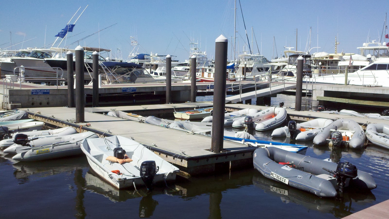
Stuart is a great town that has everything. Especially cool is the Riverwalk area on the east side of town. There are restaurants, art galleries, bars, cafes, ice cream, stores, etc. It is a very nice place to stroll. Since we were on a marina mooring ball, we were able to bring the dinghy right into the marina and tie up at their dinghy dock. Very convenient. We could walk right on the Riverwalk pier all the way to the Riverwalk part of town. There is literally a pier that wraps around the river front part of town. Very cool.


When we arrived, it was late so we ate dinner and went to sleep early. It was cold and windy. It had been a long day on the water. Most of the crossing of Lake O and the St. Lucie Canal, several bridges, and three locks was characterized by rain and wind, fog and mist. It was all generally pretty quiet, and the water was plenty deep, but traveling in that kind of weather takes concentration and you get tired by the end of the day. We were pretty wiped out. It was so beautiful, there simply are not words. It was a very welcome relief from all the “civilization” we experienced on the West Coast of Florida.
The next day, the weather was not a whole lot better, so we did a whole lot of nothing but work on the blog. As you know, this time, we did something a little different. Instead of just writing and posting photos, we thought a better way to show the OWW was through music and a slide show. Brenda, being the master video maker, found the music and then the software. Then, we had to put it all together. Finding the music turned out to be a lot more interesting. Most folks might simply find a song that mentions the word, “river” and dub the photos. Not Brenda. She went in search of a song that described the Okeechobee Waterway. This is how we discovered the music of Mike Jurgensen. Well, try as we may, we could not figure out how to download the song and use it. So, we managed to get the lyrics, and I pulled out the old guitar and started figuring it out. In the interim, we found Mike’s phone number on his website and called to see where we could get a copy of the song, “Roll on Caloosahatchee.” Well, Mike, like most folks, was not immediately available. So, in order to keep the process moving, we decided I should learn the song, and then we would record it. That was interesting in itself. The only microphone we had was part of the cheap video “eyeball” we use to Skype with. After hours of trial and error, we finally had a take we liked so we decided to cut our losses and use it. I know it is not nearly as good as Mike’s recording, but it was passable and would work out for the video. This took the better part of all day. It was not until nearly 10:30 p/m. our time that we were able to finally publish the blog. We sure had a good time making it.


The next day, I dinghied into the marina and walked into the marina office to check in and pay for the mooring ball, and then I hear this voice behind me say, “Are you Larry?” I turned around to find that it was none other than our friend John Barr whom we met and came to know at the Channel Islands Yacht Club back home. I felt terrible. I knew he had moved to Stuart, but it had completely escaped me. Nevertheless, we had a great visit with John and his friend Linda and visited his boat for cocktails and sunset. It really is a small world.


The next day, we wandered around Stuart. We discovered the Farmers Market, the chocolate place, the ice cream place, the Heritage Museum, and many other gems. The Heritage Museum is particularly cool. The building in which it lies used to be the original town feed store, general store, fertilizer store, and all around the only store. I may have also served as the post office, the pharmacy, and the apothecary. However, Stuart bought the building in 1988 and turned it over to these folks who wanted to make it into a museum. They pay $1 per month and maintain it themselves with donations and the proceeds from sales of small items. What is particularly cool is that everything that is in there was brought to them by families who lived in Stuart for generations. Additionally, unlike most museums, the stuff was not all behind glass, but was displayed right out in the open so you could get a good look at things. This place had it all from High School Yearbooks dating back to the 1950’s to photos of grandma down at the river front taken during the 1930’s and 1940’s. There was old farm equipment and all sorts of antique household goods. One could easily mistake this museum with an antique store. We learned quite a bit about this town on the river from spending time in this place.
We spent two days walking around Stuart. The weather was glorious, but we decided it was time to go.


So, on the morning of the 15th, we let go the mooring, and started heading south towards the Keys.
The passage was not at all like I thought it would be. It was quite beautiful. Jupiter Sound and Hobe Sound were fantastic. I expected nothing but Condo Hell, but found this is not the case at all. The AICW is lined with parks and mangrove. Then you get to cruise past some really beautiful homes backed right on the water. It was not the “Condomania” I was anticipating, so it is actually quite pleasant. The waterways were narrow, but as such, easy to follow and there was plenty of water for the most part. By 3:00 p.m. we were anchored in a place called Lake Worth, right out in front of the town of North Palm Beach. Now we know where a large population of mega yachts live. There are some big ones for sure.

As soon as we got anchored, Brenda went to work feverishly preparing me a birthday cake. She’s such a love. It was really good. I cannot thank all my friends and family enough for all the birthday wishes I received via email and on Facebook. It’s really nice to know so many friends care. We are a long way from home, but we think about you every day and miss you all a lot. Thank you from the bottom of my heart.

Brenda made me this beautiful cake for my birthday.
Lots and lots of candles.
It got a little smokey when I blew out the candles.
And it tasted really good, too.

At this point, we are “truckin’” south. We are not going to be investigating every little place along the way on the way down to the Keys. We want to just get there. We’ll take our time coming back up. So, for now, I have to get the boat ready to travel. It’s going to be another long day. But, a good day is a day under weigh. I’ll write more later.

//////

Lake Worth to Fort Lauderdale

What a difference a day makes. From Lake Worth, we pulled a long day all the way to Lake Sylvia, right in the heart of Fort Lauderdale. We are anchored in this small “lake” with several other cruising boats. It was a very interesting trip.

I really cannot say enough good things about the condition of the waterways down here. They are uniformly deeper (around 13 feet) and very well marked. Where the channel is purely lined with homes and banked with concrete, there are no marks, so you just stay in the middle. There are a lot of bridges, however. We went under 19 bridges yesterday, several of which we had to wait for openings. We can squirt under a 20 footer when we know there is an additional 3-4 feet at the center, and depending on the tide. However, there were plenty of them with clearances of between 5 and 15 feet that we had to stop for and have opened. Only a few of these are “on request”. The rest, operate on restricted schedules. By this I mean that some may open only on the hour and on the half hour, or they may only open on the quarters. Some only open at quarter after and quarter ‘til. It is all but impossible to time the openings just right. We nailed it a couple times. One time, however, we had to wait for nearly 20 minutes for an opening. We were traveling in a small pack with some sail boats and got slowed down, so we missed an opening, and had to wait - running in circles in a narrow channel for nearly half an hour. What a pain in the ass that was. For a while, we also got stuck behind two giant party cruisers who took up almost all of the available water. I decided that it was fine to just “live” behind these guys for a while. They are locals and they know what speed to run to make the bridge openings on their route. This worked out well. Since they are commercial, they get more deference from the bridge operators and so there was no delay. We just coat-tailed on them and passed right along.

For a while we were stuck behind this very large cruiser some Italian custom built yacht, that had some rather impressive running gear. While I never saw it, I know these boats usually have twin 5-bladed props. These things churn up the water for a long way behind them. Some of you may know what this kind of thing does to a depth sounder. Due to all the turbulence and resultant turbidity in the water, depth sounders go “nuts”. As such, for nearly 15 miles, I had no useful depth information other than the occasional flash at what I believed was an accurate depth. Now, you have to understand that I knew what was happening and so I fell even further behind. But even a half mile back, I was still getting this guy’s “gas”. So, we are running along and the depth sounder is showing 2.3,1.9, 4.5, 3.6, etc. So, I resigned to just stay in the middle and note the position of the magic magenta line, figuring this way, I would stay out of trouble.

There is an area you get into just after entering Fort Lauderdale where the AICW is lined on both sides with concrete. This area should be called, “The Bathtub.” For a protected waterway, it sure was rough. Even a canoe going by makes a little wake, right? In this area, all wakes are reverberated and magnified by the concrete walls. So, here we are, meandering our way down the middle, we have two schmucks and several smaller schmeckels go by at high speed, and it’s time to hold on because the water in this tub get’s crazy! The problem is not so much the design of the waterways as it is the boaters who operate in them. It seems there is a correlation between the size of the boat and the competence of the operator. There is little respect shown other boaters as these yahoos in their small runabouts feel compelled to tear through no wake zones at high speed. I guess they figure that, when on plane, they are not making much of a wake. This is actually true, but it’s still discourteous to other boaters. There seems like there is little or no enforcement of any water laws around here.

On the trip to Fort L, we saw some of the most magnificent yachts we have ever seen. All the biggies are down here. There is a sign on the bridge when you cross into Fort L that says, “Welcome to Fort Lauderdale, the Yachting Capital of the World.” No kidding! It seems like nothing under 150 feet even has any business being here. Burgers, Fedships, Symbols, Johnsons, etc. All the big designers are well represented. Brenda and I nearly fell off the boat when I commented at one point, “Now that’s a really big Johnson.” We laughed so hard. We’re still laughing.


There is a Mega Yacht in the background that is completely shrink wrapped.

It is nice that, while there are some giant mega condo highrises, the waterways were mostly lined with big, beautiful homes. This made the trip interesting. There are as many styles of architecture as there are colors with which these homes are painted. There was an abundance of infinity pools, fountains, and statuary. What was most wonderful, however, were the gardens. Tropical, tropical, tropical is the only way to describe the gardens. Many varieties of broad leafs, palms, and other colorful plants, banyan trees, banana trees, and even cocoanut palms. No more pine trees. The many colors of the gardens against the many colors of the homes gives this place a really nice palate to enjoy. Some might consider this place ideal. I love it, but I’m not convinced it’s the right place for me.

Last night after we arrived, we hopped in the dinghy and went to a place called Southpoint Raw Bar. It was a 5 minute dinghy ride. Great food, great prices, and a lot of fun. Even though it rained while we were sitting out on their deck, it didn’t matter. It was warm and tropical out.


What a nice change from the frozen bayous of the panhandle. We got pretty soaked on the ride back to the boat, but it was fun.

We are very close to the Keys now and some serious preparation is in order. Fortunately, it is windy today, and we plan to stay put for the day anyways. I have guidebooks to read, charts to download and print, fuel planning to do, and several other chores to keep me busy and the boat off the bottom. It’s quite a bit more complicated if you’ve never been here before. It’s not as simple as pulling up to Coches Prietos and dropping a hook. I suppose, however, for the cruiser who has never been there, it is complicated as well. You have to simply understand where you are going and consider the information available to you. What makes it difficult is the abundance of information. Sometimes, it can simply be overwhelming. So, I find it is best to break it down into smaller bites: here to there, then here to there. If you try to plan the whole thing, you will make a mistake. Down in the keys, running aground doesn’t always mean a soft landing in the mud. Coral abounds. Not only do you screw up the boat, but the authorities really frown on boaters who do damage to their coral and grass beds. Again, it is a matter of figuring it out. And, we will. It’ll just be a little at a time. That being said, I better get to work.

Bye, Y’all.


Saturday, February 12, 2011

THE OKEECHOBEE WATERWAY


The Okeechobee Waterway is one of the most impressive creations of man and God.  Most people have never heard of it and most do not realize that it is possible to cross the middle of the state of Florida, from Fort Meyers to Stuart by water.  Its main segments are the St. Lucie Canal, Lake Okeechobee, Lake Hicpochee, and Caloosahatchee River. The shallow (6 ft/1.8 m) waterway has four locks and is used by small commercial and leisure craft. It is also an outlet for the floodwaters of Lake Okeechobee.


This is an image which shows the route.  We left Fort Myers and turned right.  We ran up the Caloosahatchee River which turns into the Okeechobee Waterway (OWW).  Then we stopped in the town of LaBelle for a night and anchored in the river.  From there, we merged onto the Caloosahatchee Canal which took us through a couple locks and finally to the town of Clewiston which is on the banks of Lake Okeechobee.  From there, we crossed the lake and entered the St. Lucie Canal.  This canal took us to the St. Lucie River which took us to the town of Stuart, Florida.  All in all, the OWW is approximately 155 statute miles from start to finish.  It was a most beautiful and amazing part of our voyage.

I think the OWW is best described in a video we made.  The lyrics to the music were written by singer/songwriter Mike Jurgensen who wrote and performs a number of interesting folksongs about Florida and her environs.  His music can be experienced if you go to http://www.mikejurgensen.com/ and you can listen to various clips of his great music if you go to


We thank Mike for his great lyrics.  We are especially thankful that his song tells the story of the OWW and saves me from having to do it.  Click on the picture below to view the video.


The Caloosahatchee basin as it exists today was formed by Pliocene and Pleistocene sediments deposited by fluctuating sea levels over one million years ago. As sea levels receded, a mainland emerged with a series of lakes connected by wet prairies in a shallow valley which stretched between an inland sea and a gulf. From a tiny lake in the center of the valley a waterfall fed a river which flowed to the gulf.

The first humans inhabited this region over ten thousand years ago. The lush flora and fauna of the valley provided an ample food supply and the materials to make food, clothing and shelter.

The early Spanish explorers wrote of this region in the early 1500's.  They gave names to many of the things they encountered here, which names are still in use today.  These included the Calusa and the Mayaimi; the waterway, River of the Calusa; the inland sea the Mayaimi Lagoon -Big Water; and the peninsula, Florida for the variety of flora found here.
The Seminole indians fled to this area from Alabama and Georgia in the mid-1700's. Like the Spanish, the Seminole left a legacy of many place names. The Mayaimi Lagoon became Lake Okeechobee, and the river became the Caloosahatchee. The name Florida survived.

After the Civil War in the 1860's, homestead opportunities attracted many southerners and squatters to Florida. Settlements were built as far south as the Caloosahatchee.

Twenty years later in 1881, Florida Governor William Bloxham persuaded Philadelphia toolmaker and developer, Hamilton Disston, to purchase four million acres of South Florida at twenty five cents per acre.  At this time, the Caloosahatchee basin, with seasonal wet prairies, provided a connection between the lakes in the valley flowing to the Gulf of Mexico.  As such, Disston's first project in southwest Florida was to drain the land around Lake Okeechobee. He enlisted the expertise of cattlemen Jacob Summerlin and Capt. Francis Asbury Hendry to survey a route east from Lake Flirt through wetlands connecting Lakes Lettuce, Bonnett and Hicpochee. At the eastern end of Lake Hicpochee the route followed an existing Paleo or Mayaimi Indian canal to Lake Okeechobee.

In September 1881, Disston brought a dredge into Fort Myers and began dredging a 48 ft. canal from Ft. Thompson (11/4 miles east of LaBelle) to Lake Okeechobee.

Despite these drainage efforts the powerful hurricanes of 1926 and 1928 caused significant flooding and loss of life at Moore Haven and Clewiston. Demand for relief from the repeated flooding reached Washington in the midst of an economic depression. The Army Corps of Engineers worked with the Flood Control District to improve the region's flood control.

After the 1928 hurricane President Hoover visited the area to view the devastation and recommended assistance to prevent future flooding. In 1930, Congress appropriated money to construct the Hoover Dike around Lake Okeechobee.

Over the next several years, the winding Caloosahatchee was all but transformed by dredges into a straight deep channel.

As part of the 1930 flood control project, the St. Lucie River and Caloosahatchee were dredged and channelized creating the Cross-State Ship Channel. This channel, now known as the Okeechobee Waterway, or C-43 Canal, links the Gulf of Mexico to the Atlantic Ocean.


Monday, February 7, 2011

FORT MYERS, FLORIDA AND THE MOUTH OF THE CALOOSAHATCHEE RIVER

 I recall, many years ago, when I worked with a guy I met named Ric. He once told me of his interest in a place in Florida called Fort Myers. I remember looking at a map and wondering why he would want to move there. I guess I was quite near sighted back in those days. Having visited the city, now I would have no choice but to exclaim what a great idea that would be. This is a city that truly has it all, and if it doesn’t have it, a town very nearby will.

For Myers is not actually “on” the Gulf. Rather, it is several miles up the Caloosahatchee River which is part of the Okeechobee Waterway that connects the Gulf and Atlantic coasts of Florida. As such it is uniquely situated. With a car, you could be on the Atlantic coast in a matter of a couple hours or less. Yet, what I think I like most about this place is the climate. It is possible to grow just about anything here and, based on what I learned, Thomas Edison did just about that.

Fort Myers is also the county seat and the locale for several other state and federal offices. As such, the logistics are in place for lots of things to do. While we could never have had the time to sample everything, it’s good to know that if you like culture, it is here. If you like art, you will simply be overwhelmed. If you like outdoor activities, FM is definitely the place.

We left St. James City after the fog lifted and made our way through and past the last mile marker of the West Florida ICW, MM 0. Then, we turned left and headed up the Caloosahatchee River towards Fort Myers. The water changed dramatically. Gone are the turquoise blue and sea foam green waters. You are back in the tannic brackish waters typically found at the mouth of waterways. Yeah, the kind that put that ugly brown moustache on your hull. And, the water isn’t warm, either. So, we located the City of Fort Myers Yacht basin and they talked us in.


A little "baby" tug just outside of St. James City, FL.

Now THAT'S what I call "trailer".  Hey, Jed, where's Ma?!


Oh yeah.  A private BBQ Island.


This marina is located between two bridges that cross the C River. I really cannot say enough good things about this marina. First, it is a municipal marina, but you wouldn’t know it based on the service you receive. When we got in, a uniformed dockmaster met us and assisted us backing in between two poles and back in place up against a concrete fixed pier. Perfect. Next, he helped us pull the power cord over to the pedestal. Very nice. Then he gave us the rundown in terms of where everything was. He was very courteous and helpful. We had a nice slip with a good view. Unfortunately, as in just about every marina we have ever been in (with the exception of Ventura Isle Marina back in California), the air flow was pretty bad. Nevertheless, we came into the marina with a purpose or two – get the boat washed down with fresh water, fill all tanks that needed to be filled, empty all the tanks that needed to be emptied, do like 10 loads of laundry, and get some groceries. We accomplished this all in about 1.5 days, before moving out to the anchorage and the fresh air.

We apparently arrived just in time to enjoy the art festival that takes place on the first weekend of every month, including the Friday Night Art Walk. On the first Friday of each month, the galleries that inhabit the historic downtown area stay open late. Folks come from all over to walk the streets, drink wine, and peruse the galleries. There is a central town plaza with live music, and the waterfront is lined with tents where literally hundreds of artists display their work. There is food and drink galore – everything from hotdogs, to shish kabob, and gyros. Several musicians are tactically placed throughout the grounds so their music does not necessarily overlap and can be enjoyed. As I said, thousands of people came from all over to enjoy the weekend art festival.

Even after moving out to the anchorage, we could still easily come into town and enjoy ourselves. The marina charges nothing for dinghies to tie up at their dinghy dock, but if you want to use the facilities (shower, bathrooms, laundry, oil disposal, etc.), you had to pay a whopping $5.00. Very cool.
We visited the art show a couple times. On Friday night, we went into town and listened to a fine 50’s style band from the balcony of a nice restaurant overlooking the plaza. That was really nice. Saturday was kind of a cool, overcast and windy day. We pretty much stayed on the boat, but had a visit from a guy we met on a boat anchored behind us. His name is Rob. He retired after a full lifetime career in the Navy. He was a weatherman/navigator and, as such, spent close to 30 years in the wheel house of a variety of different ships including Cruisers and Destroyers. He and I had a lot to talk about. Of particular interest was his discussion regarding clouds. Every waterman should know something about cloud interpretation. The clouds can tell you more about what is happening in your immediate vicinity than most computers. This is what I refer to as real “on the ground” weather forecasting. Without getting into too much detail, if you watch the clouds as they form and as they change over a period of time, coupled with a look at the barometer, you can make a pretty accurate weather prediction for your immediate area. Over a significant number of beers, Rob and I debated over whether or not it would rain. He believed it would. My view of the clouds and the barometer said it wouldn’t. I won. It didn’t rain at all Saturday night. Dry as a bone. Ha ha. He owes me a brewery, now. (Which, coincidently, is a good thing since I owe my friend Dan a 12’er since the Steelers sucked on Sunday!)

Sunday morning, we left the boat fairly early and headed into town to visit the Edison and Ford Summer Estates. That’s right, that’s Thomas Edison and Henry Ford. Can you possibly imagine having those two guys alive at the same time and in the same place; actually working together and virtually simultaneously making discoveries, and inventing technologies that would shape the planet we live on? Their buddies Firestone and Westinghouse also hung out and vacationed in these parts. Notably, they were wintering here in Fort Myers at or about the same time as Ringling was wintering barely 60 miles up the road (ICW) in Sarasota. I can only imagine what an exciting time it must have been; to have been alive during the spark phase of the industrial revolution when brilliant men came up with brilliant ideas and put them to use to shape life as it would become. The details don’t matter. Going to their summer estates leaves a mark if you have the wherewithal to comprehend the magnitude of their work, their ideas, their inspirations.


Mr. Edison in amongst his Banyan Tree.


Edison's pool.

The "Moon Garden"


I always knew that Edison invented the light bulb. I hadn’t paid attention to the fact that he also developed DC electricity, phonographs, recording devices, typing and printing devices, stock tickers, movie production houses, movie projectors, and so many other things. Of great interest was the fact that he worked to develop a natural source of rubber because he was concerned with our country’s dependence on foreign rubber. He was quite the botanist and developed strains of Goldenrod that would produce the raw materials for making rubber. He felt it could be grown and harvested like wheat. Shortly before his death, he proclaimed he needed about 2 more years to perfect his idea. Sadly, he died before it was realized. However, his wife Mina and his friends Ford and Firestone carried on the project for a couple more years before they realized it was not going anywhere in the world of synthetic rubbers that could come from petro-chemical processes.

Edison's pier was once 1500 feet long and had a house at the end.

This is a photo of a photo showing the end of the pier in 1926.


Another very interesting story was based on the fact Edison actually invented the Electric Chair – yes, “Old Sparky.” As the story goes, his competitor, Westinghouse, was working on Alternating Current or AC electricity. Edison believed his DC was better and safer in the home. So, he developed the electric chair which would use AC and argued that nobody would want this current that they use to execute murderers in their household. Ultimately, Edison lost that argument.

Edison loved the water and built probably the first electric boat powered by batteries. Brenda refers to it as the first “Duffy” since she has one at home. Edison’s was substantially larger, but the concept is the same. Use battery power to run a motor that turns a shaft and a propeller. The hull shapes are similar, and the canvas coverings look similar, but that is about where it ends.


It's a little bigger than the "Dog & Butterfly"


I had no idea either that Henry Ford actually worked for Edison at one of his factories in Michigan. Edison apparently commissioned Ford to develop a gasoline engine. Again, the details escape me, but intrigues me, again, is the work that was being accomplished in the late 1800s and early 1900s. Although most of the credit for the development of the automobile goes to Ford, it would not be quite what it was or is had it not been for Edison’s development of batteries and DC electricity. Could you imagine a car without a CD player or headlights? It is amazing to me that virtually every piece of technology we enjoy today has its roots in Edison’s work. If he was head and shoulders above most of the rest of the inventors of the time, then he is certainly a giant among men of all times.


 These two fellows were great friends. After Edison visited this area and fell in love with it, he bought 13 acres on the banks of the Caloosahatchee. Ultimately, he would acquire many, many more. He loved plants and had a wide variety of species brought in from all over the world. Today, his gardens are an amazing amalgamation of plant species from all over the world, including exotics such as orchids and wonderful fruit trees. He built lovely structures on the premises as well, including his home, office, and guesthouse, and laboratory, all of which you can visit. It is also a little known fact that, Edison invented cement. So, he took some cement, some aggregate, twisted metal, and built what may be one of the first concrete swimming pools. It’s still there.

Ford came to visit Edison often. He also loved the climate and the environs. He loved it so much that, when Edison’s neighbor was going to sell his adjacent property, he wrote to Edison and offered to give Henry the first right of refusal. Of course, Henry bought the place, and the two friends lived and worked together in Fort Myers for several years before Edison died. Thus, the Edison and Ford Summer Estates and museum.

Mr. Henry Ford.


I love a place where the orchids grow like this.
 Following a long day wandering around the estates and then downtown Fort Myers, we returned to the boat and rested before going back into town to watch the Superbowl at a local establishment called the Hideaway Sports Bar. They got permits to close the street in both directions in front of the place and had a big screen placed on the sidewalk across the street. They set up an out door bar and grill. They cooked up burgers and wings and poured great drinks. Budweiser was a big sponsor of this party so there were lots of gifts and “giveaways”. The crowd was not raucous at all and everyone seemed to really enjoy themselves. We left just after half time and headed back to the boat.


Overall, our experience in Fort Myers has been first class all the way and we are very glad we stopped here and spent a couple extra days visiting this cool city on the river. Today, we will up the anchor and head up the river towards Lake Okeechobee and ultimately the Atlantic Coast of Florida. It’s around 120 nm across, so we’ll break it up into a few days. Tonight, the plan is to stop in the town of La Belle where they are said to specialize in honey and alligator. That should be an interesting stop. They say middle Florida is pretty wild and pretty remote, like it was 50+ years ago. It will be quite a change.

That’s it for now. Bye Y’all.